MyTopo
Bracket Butte Montana US Topo Map
Couldn't load pickup availability
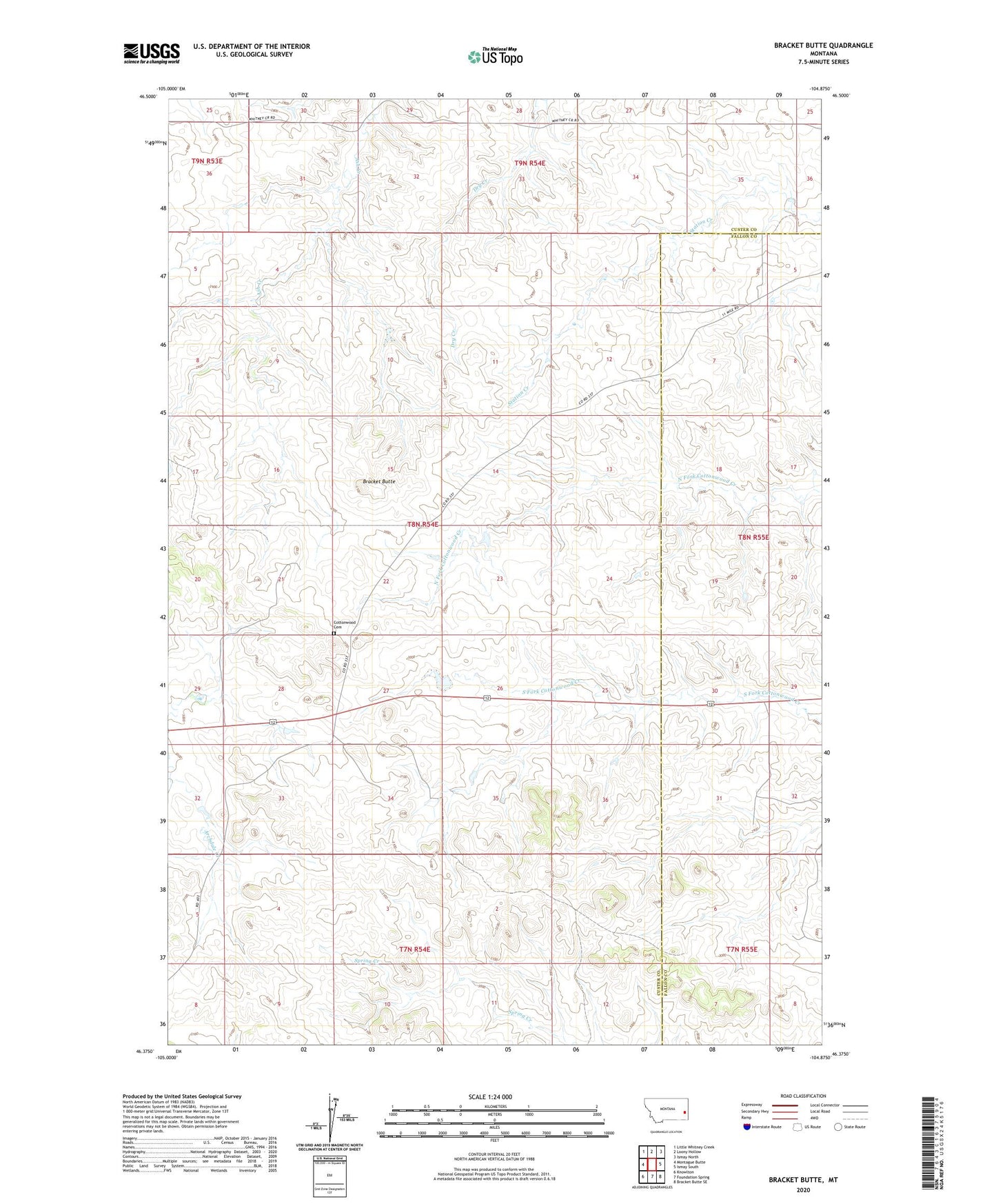
2024 topographic map quadrangle Bracket Butte in the state of Montana. Scale: 1:24000. Based on the newly updated USGS 7.5' US Topo map series, this map is in the following counties: Custer, Fallon. The map contains contour data, water features, and other items you are used to seeing on USGS maps, but also has updated roads and other features. This is the next generation of topographic maps. Printed on high-quality waterproof paper with UV fade-resistant inks.
Quads adjacent to this one:
West: Montague Butte
Northwest: Little Whitney Creek
North: Loony Hollow
Northeast: Ismay North
East: Ismay South
Southeast: Bracket Butte SE
South: Foundation Spring
Southwest: Knowlton
This map covers the same area as the classic USGS quad with code o46104d8.
Contains the following named places: 06N54E12BC__01 Well, 07N54E04CCAC01 Well, 07N54E28A___01 Well, 07N55E05CA__01 Well, 08N54E11BA__01 Well, 08N54E15DD__01 Well, 08N54E17A___01 Well, 08N54E20DD__01 Well, 08N54E21BAA_01 Well, 08N54E21CCCC01 Well, 08N54E21CCCC02 Well, 08N54E22ABAA01 Well, 08N54E29AD__01 Well, 08N54E34ADAC01 Well, 08N54E34CD__01 Well, 08N54E36CDBA01 Well, 08N55E06DA__01 Well, 08N55E06DA__02 Well, 08N55E07AA__01 Well, 08N55E32DAAA01 Well, Bracket Butte, Cottonwood Cemetery, Cottonwood School, Gray Number 3 Dam, McKee Well