MyTopo
Knowlton Montana US Topo Map
Couldn't load pickup availability
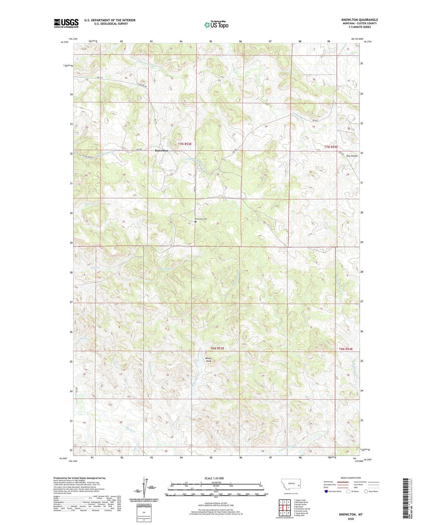
2024 topographic map quadrangle Knowlton in the state of Montana. Scale: 1:24000. Based on the newly updated USGS 7.5' US Topo map series, this map is in the following counties: Custer. The map contains contour data, water features, and other items you are used to seeing on USGS maps, but also has updated roads and other features. This is the next generation of topographic maps. Printed on high-quality waterproof paper with UV fade-resistant inks.
Quads adjacent to this one:
West: Red Knob
Northwest: Hogan Creek
North: Montague Butte
Northeast: Bracket Butte
East: Foundation Spring
Southeast: Hooky Dam
South: Tepee Butte NE
Southwest: Pennock Creek
This map covers the same area as the classic USGS quad with code o46105c1.
Contains the following named places: 06N53E19AA__01 Well, 07N53E16DBAD01 Well, 07N53E16DBDA01 Well, 07N53E16DBDA02 Well, 07N53E23DDCA01 Well, 07N53E23DDCD01 Well, 07N53E26CC__01 Well, 07N53E35BBCA01 Well, 07N54E17ACCB01 Well, 07N54E17CBCD01 Well, 07N54E18BDC_01 Well, 07N54E20ABDC01 Well, 07N54E28A___02 Well, 07N56E26ABDA01 Well, 59336, Cedar Creek, Dry Coulee, Foxey Creek, George Park, Gilman Ranch, Knowlton, Knowlton Cemetery, Knowlton Post Office, Knowlton School, Rock Creek, White Knob, White Knob Creek