MyTopo
Moon Creek School Montana US Topo Map
Couldn't load pickup availability
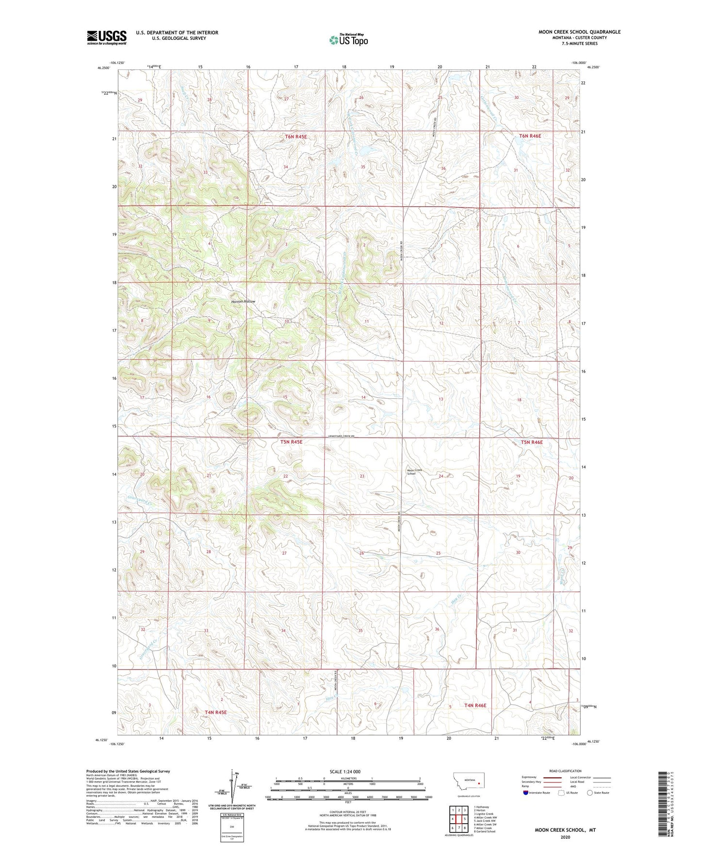
2020 topographic map quadrangle Moon Creek School in the state of Montana. Scale: 1:24000. Based on the newly updated USGS 7.5' US Topo map series, this map is in the following counties: Custer. The map contains contour data, water features, and other items you are used to seeing on USGS maps, but also has updated roads and other features. This is the next generation of topographic maps. Printed on high-quality waterproof paper with UV fade-resistant inks.
Quads adjacent to this one:
West: Miller Creek NW
Northwest: Hathaway
North: Horton
Northeast: Lignite Creek
East: Jack Creek NW
Southeast: Garland School
South: Miller Creek
Southwest: Miller Creek SW
Contains the following named places: 05N43E29DCDC01 Well, 05N45E13DDCB01 Well, 05N46E07BADC01 Well, 06N45E26CACD01 Well, 11N45E31DAAC01 Well, Hay Creek, Lockie Number 2 Dam, Lockie Number 3 Dam, Lockie Number 4 Dam, Lockie Number 7 Dam, McLean Number 1 Dam, Moon Creek, Moon Creek Post Office, Moon Creek School