MyTopo
Hathaway Montana US Topo Map
Couldn't load pickup availability
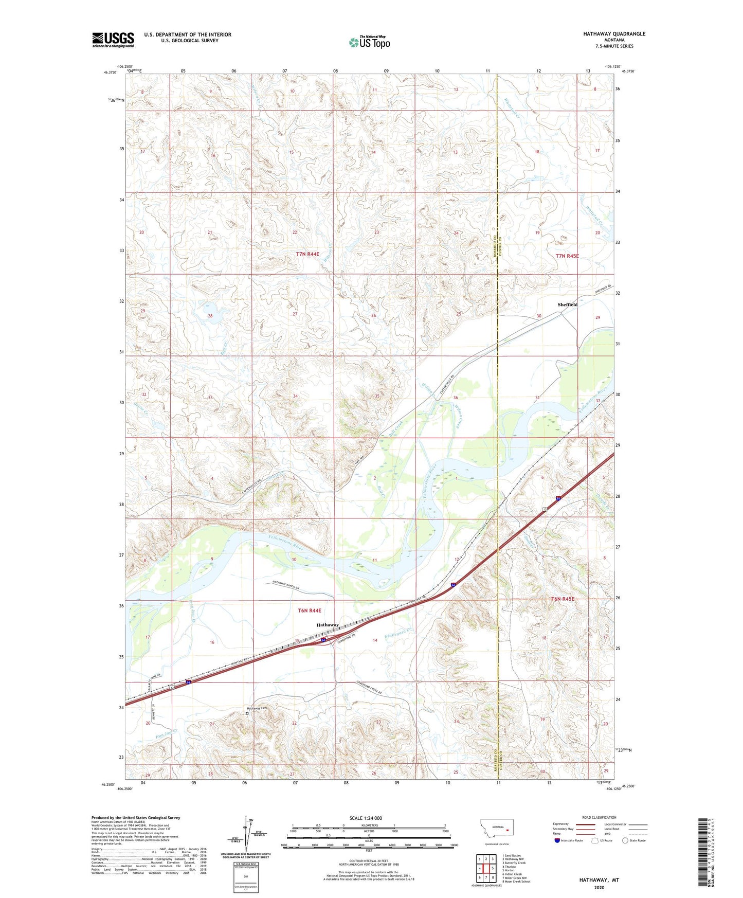
2024 topographic map quadrangle Hathaway in the state of Montana. Scale: 1:24000. Based on the newly updated USGS 7.5' US Topo map series, this map is in the following counties: Rosebud, Custer. The map contains contour data, water features, and other items you are used to seeing on USGS maps, but also has updated roads and other features. This is the next generation of topographic maps. Printed on high-quality waterproof paper with UV fade-resistant inks.
Quads adjacent to this one:
West: Thurlow
Northwest: Sand Buttes
North: Hathaway NW
Northeast: Butterfly Creek
East: Horton
Southeast: Moon Creek School
South: Miller Creek NW
Southwest: Indian Creek
This map covers the same area as the classic USGS quad with code o46106c2.
Contains the following named places: 06N44E14BCBC01 Well, 06N44E20DCB_01 Well, 06N44E22BAC_01 Well, 07N44E36C___01 Well, 59333, Bull Creek, Calabar School, Goose Creek, Graveyard Creek, Hathaway, Hathaway Cemetery, Hathaway Post Office, Hathaway School, Hook Number 2 Dam, Hook Number 62 Dam, Hook Number 67 Dam, Iron Jaw Creek, Lock Bluff, Sheffield, Sheffield Post Office, Snell Creek, Theade Creek, Wilson Creek