MyTopo
Miller Creek NW Montana US Topo Map
Couldn't load pickup availability
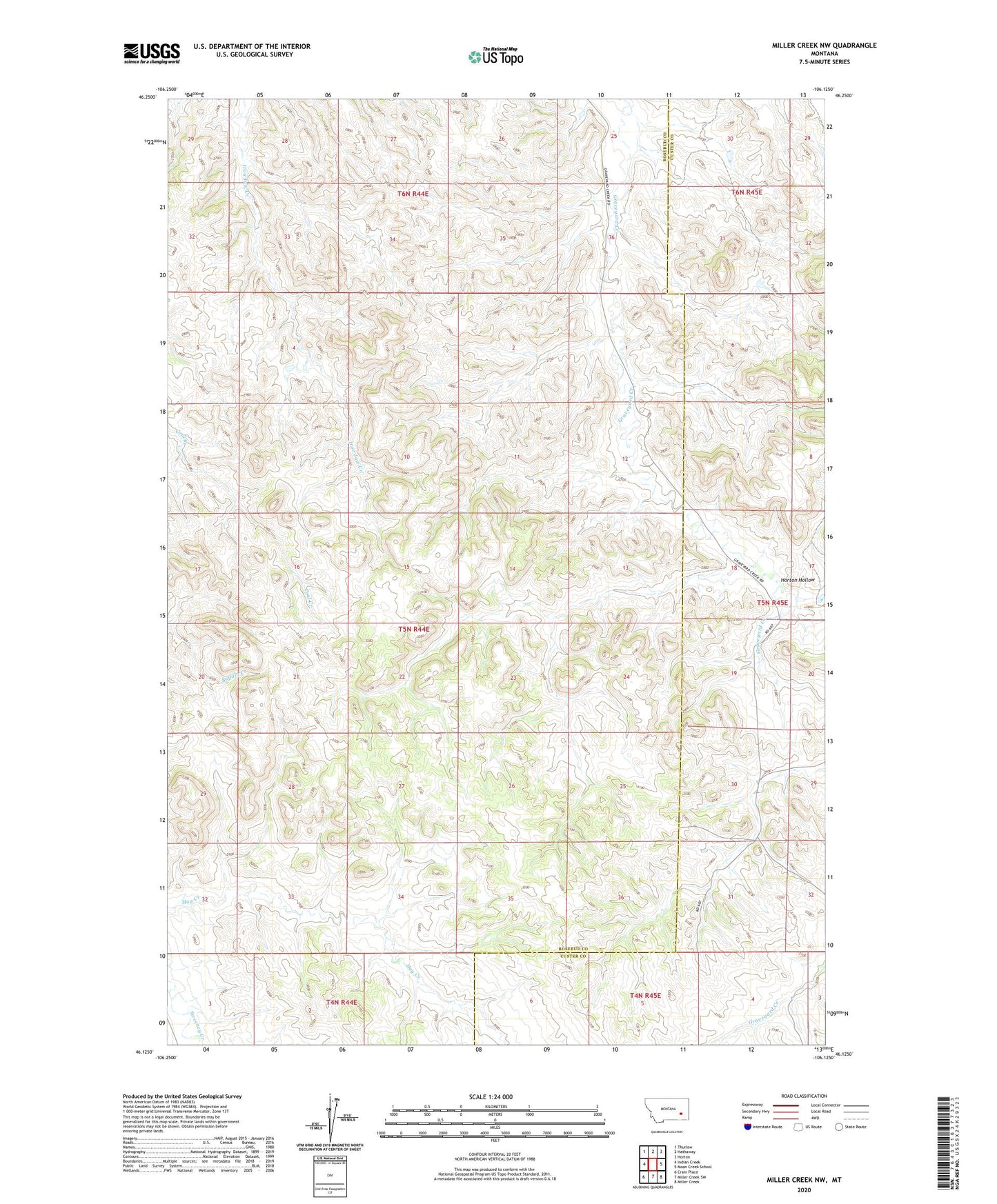
2024 topographic map quadrangle Miller Creek NW in the state of Montana. Scale: 1:24000. Based on the newly updated USGS 7.5' US Topo map series, this map is in the following counties: Rosebud, Custer. The map contains contour data, water features, and other items you are used to seeing on USGS maps, but also has updated roads and other features. This is the next generation of topographic maps. Printed on high-quality waterproof paper with UV fade-resistant inks.
Quads adjacent to this one:
West: Indian Creek
Northwest: Thurlow
North: Hathaway
Northeast: Horton
East: Moon Creek School
Southeast: Miller Creek
South: Miller Creek SW
Southwest: Crain Place
This map covers the same area as the classic USGS quad with code o46106b2.
Contains the following named places: 05N44E22DBBC01 Well, 05N44E35BCAC01 Well, 06N44E25DCBA01 Well, 06N44E36CACD01 Well, 06N44E36CACD02 Well, 06N44E36CACD03 Well, Crabtree Post Office, Hook Number 72 Dam, Horton Hollow