MyTopo
Moorhead Montana US Topo Map
Couldn't load pickup availability
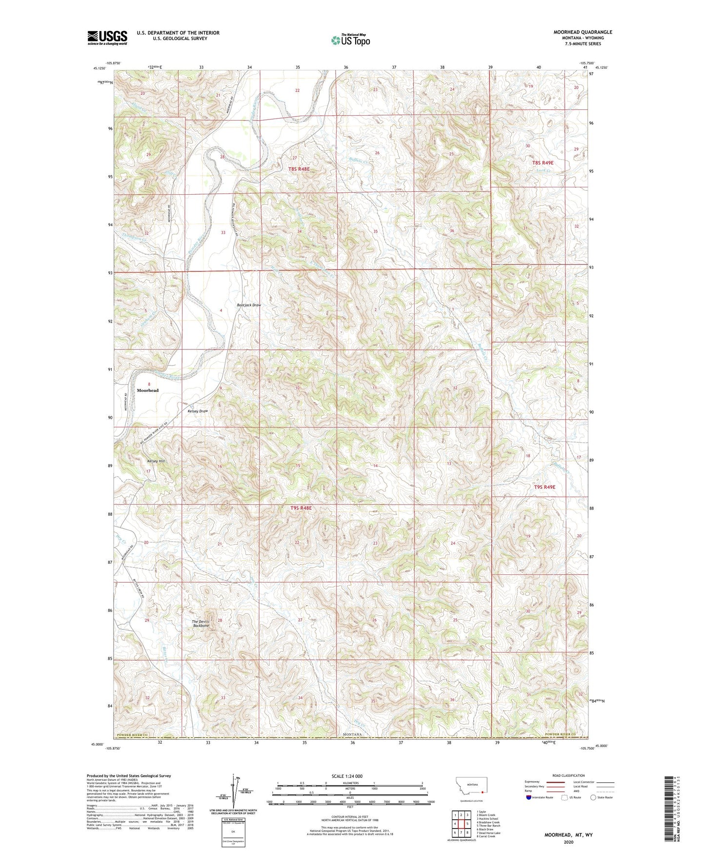
2020 topographic map quadrangle Moorhead in the state of Montana. Scale: 1:24000. Based on the newly updated USGS 7.5' US Topo map series, this map is in the following counties: Powder River, Campbell. The map contains contour data, water features, and other items you are used to seeing on USGS maps, but also has updated roads and other features. This is the next generation of topographic maps. Printed on high-quality waterproof paper with UV fade-resistant inks.
Quads adjacent to this one:
West: Bradshaw Creek
Northwest: Sayle
North: Bloom Creek
Northeast: Huckins School
East: Three Bar Ranch
Southeast: Corral Creek
South: Dead Horse Lake
Southwest: Black Draw
Contains the following named places: 08S49E32CB__01 Well, 09S48E01BBDB01 Well, 09S48E05AC__01 Well, 09S48E05ACDC01 Well, 09S48E05ACDD01 Well, 09S48E08CABC01 Well, 09S48E08CDB_01 Well, 09S48E12AC__01 Well, 09S48E27DBCB01 Well, Bootjack Draw, Buffalo Creek, Cliff Creek, East Thompson Creek, Flood Creek, Graham Creek, Jenkins Creek, Kelsey Draw, Kelsey Hill, Moorhead, The Devils Backbone, Thompson Creek, Well Creek