MyTopo
Black Draw Wyoming US Topo Map
Couldn't load pickup availability
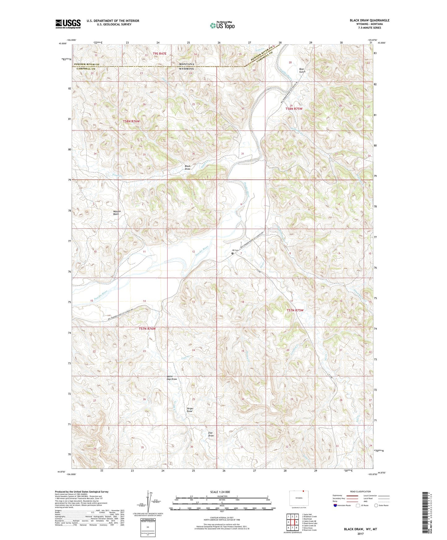
2021 topographic map quadrangle Black Draw in the states of Wyoming, Montana. Scale: 1:24000. Based on the newly updated USGS 7.5' US Topo map series, this map is in the following counties: Campbell, Powder River. The map contains contour data, water features, and other items you are used to seeing on USGS maps, but also has updated roads and other features. This is the next generation of topographic maps. Printed on high-quality waterproof paper with UV fade-resistant inks.
Quads adjacent to this one:
West: Cabin Creek NE
Northwest: Sayle Hall
North: Bradshaw Creek
Northeast: Moorhead
East: Dead Horse Lake
Southeast: Reservoir Creek
South: Kline Draw
Southwest: Cabin Creek SE
This map covers the same area as the classic USGS quad with code o44105h8.
Contains the following named places: Bear Gulch, Black Draw, Coal Creek, Crooked Creek, Dead Horse Creek, ER Cemetery, Fence Creek, Flat Draw, Greenough Dam, Greenough Reservoir, L X Bar Creek, Line Creek, Long Creek, SA Creek, Short Creek, Spring Creek, Warren Dam, Warren Reservoir, Water Gap Draw, Watson Basin, Williams Creek, Yerger Draw