
MyTopo
Mossmain Montana US Topo Map
Couldn't load pickup availability
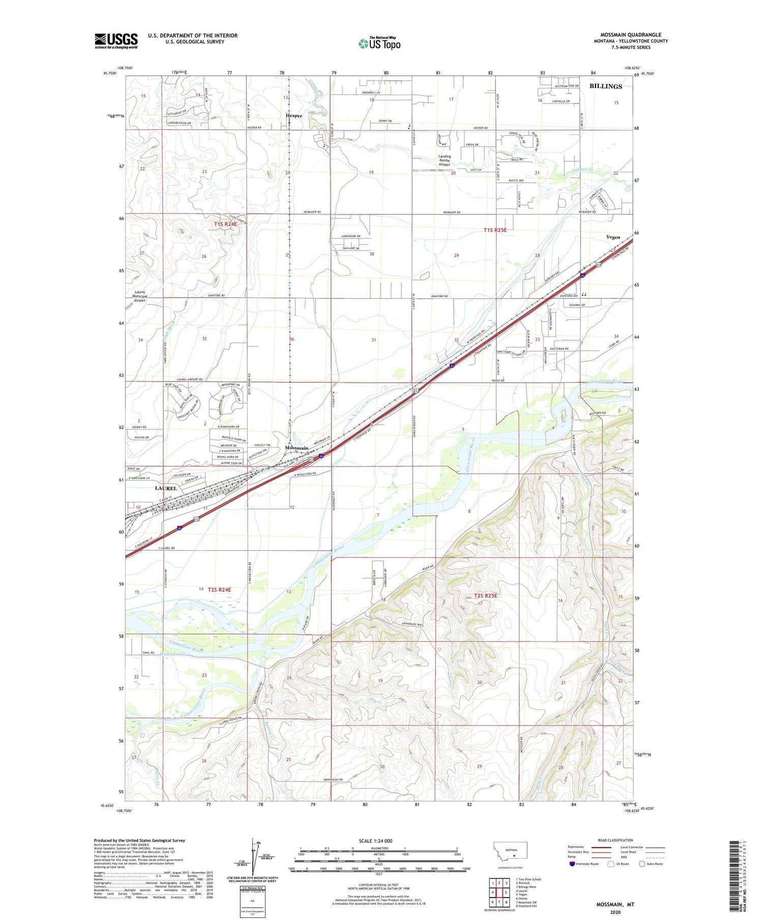
2020 topographic map quadrangle Mossmain in the state of Montana. Scale: 1:24000. Based on the newly updated USGS 7.5' US Topo map series, this map is in the following counties: Yellowstone. The map contains contour data, water features, and other items you are used to seeing on USGS maps, but also has updated roads and other features. This is the next generation of topographic maps. Printed on high-quality waterproof paper with UV fade-resistant inks.
Quads adjacent to this one:
West: Laurel
Northwest: Two Pine School
North: Rimrock
Northeast: Billings West
East: Yegen
Southeast: Stratford Hill
South: Mossmain SW
Southwest: Silesia
Contains the following named places: 01S24E23DDDD01 Well, 01S24E24DDDD01 Well, 01S24E25DDDC01 Well, 01S24E26DDAA01 Well, 01S24E35BCCC01 Well, 01S24E36CCBC01 Well, 01S25E15CCCC01 Well, 01S25E16CBCC01 Well, 01S25E17CCDD01 Well, 01S25E18CCCC01 Well, 01S25E21CBBB01 Well, 01S25E21DDDD01 Well, 01S25E27CBBC01 Well, 01S25E27CCCC01 Well, 01S25E29AAAA01 Well, 01S25E29BBCB01 Well, 01S25E29DDDD01 Well, 01S25E31ADAD01 Well, 01S25E32DAAA01 Well, 02S24E01AAAB01 Well, 02S24E02DADD01 Well, 02S24E03DADA01 Well, 02S24E12A___01 Well, 02S24E12AABB01 Well, 02S24E12BBBD01 Well, 02S24E12CCAD01 Well, 02S24E13DDAA01 Well, 02S24E14ABBB01 Well, 02S24E15DADA01 Well, 02S24E22A___01 Well, 02S24E23ACAA01 Well, 02S25E04AACB01 Well, 02S25E04BCBD01 Well, 02S25E04CCCB01 Well, 02S25E06ACDC01 Well, 02S25E07BCBC01 Well, 02S25E07DDBB01 Well, 02S25E15C___01 Well, 02S25E18BBBC01 Well, 59044, Canyon Creek Ditch, Clarks Fork Yellowstone River, Davis Creek, Davis Ditch, Dry Creek, Duck Creek, East Fork Duck Creek, Elder Grove School, Hesper, High Ditch, Landing Pointe Airport, Laurel Division, Laurel Stockyards, Line Creek, Mossmain, Riverside Park Boat Ramp, Spring Creek


