MyTopo
Mossmain SW Montana US Topo Map
Couldn't load pickup availability
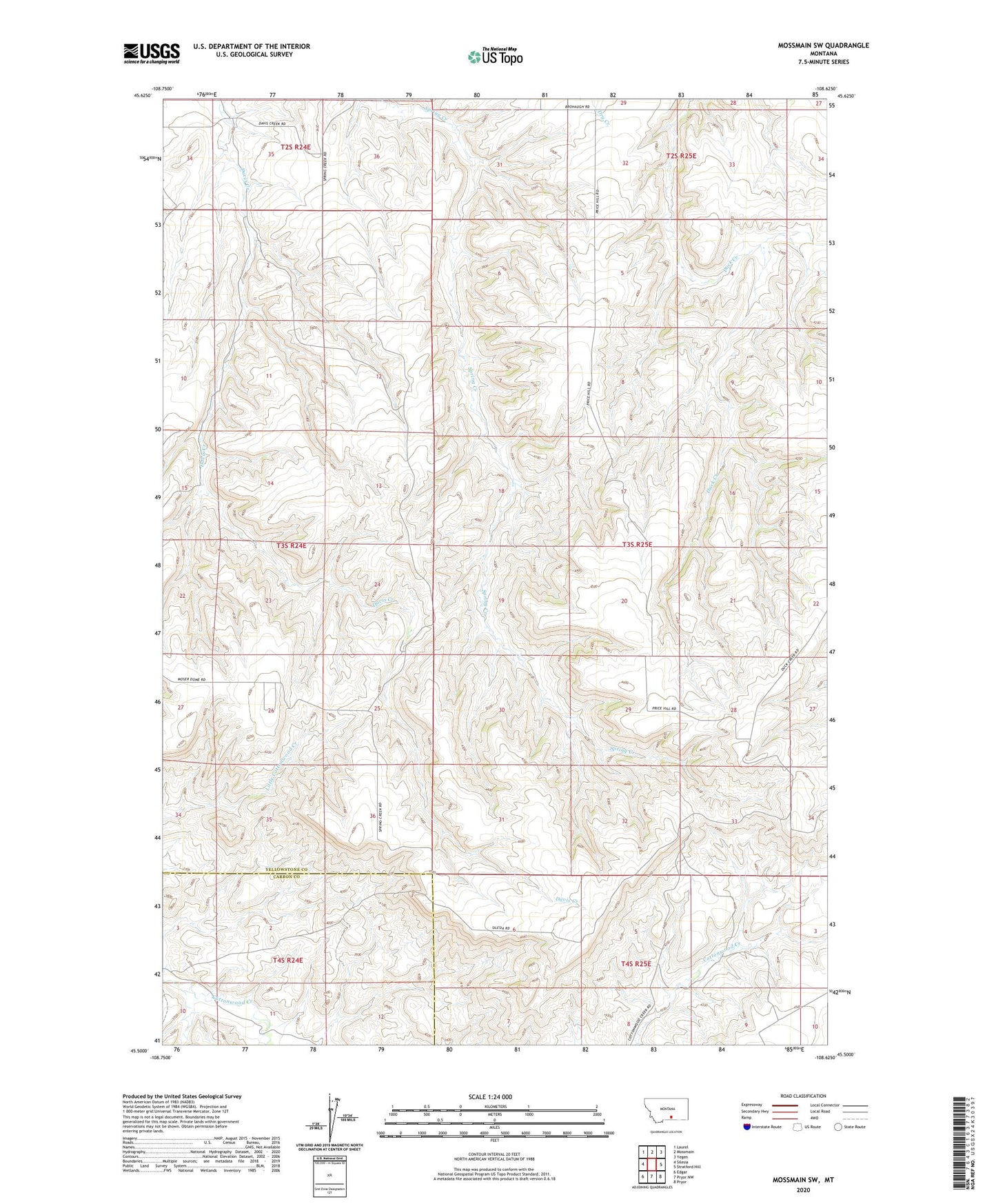
2024 topographic map quadrangle Mossmain SW in the state of Montana. Scale: 1:24000. Based on the newly updated USGS 7.5' US Topo map series, this map is in the following counties: Yellowstone, Carbon. The map contains contour data, water features, and other items you are used to seeing on USGS maps, but also has updated roads and other features. This is the next generation of topographic maps. Printed on high-quality waterproof paper with UV fade-resistant inks.
Quads adjacent to this one:
West: Silesia
Northwest: Laurel
North: Mossmain
Northeast: Yegen
East: Stratford Hill
Southeast: Pryor
South: Pryor NW
Southwest: Edgar
This map covers the same area as the classic USGS quad with code o45108e6.
Contains the following named places: 03S16E23ABDB01 Well, 03S24E01CAAB01 Well, 03S24E12A___01 Well, 03S25E04A___01 Well, 03S25E06B___01 Well, 03S25E07C___01 Well, 03S25E18A___01 Well, KRKX-FM (Billings), Mosser Dome Oil Field, Spring Creek School