MyTopo
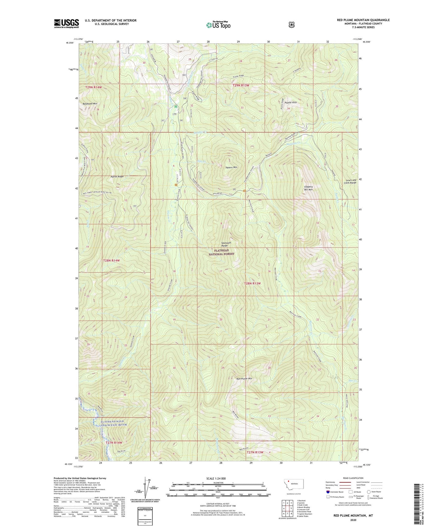
Red Plume Mountain Montana US Topo Map
Couldn't load pickup availability
Also explore the Red Plume Mountain Forest Service Topo of this same quad for updated USFS data
2024 topographic map quadrangle Red Plume Mountain in the state of Montana. Scale: 1:24000. Based on the newly updated USGS 7.5' US Topo map series, this map is in the following counties: Flathead. The map contains contour data, water features, and other items you are used to seeing on USGS maps, but also has updated roads and other features. This is the next generation of topographic maps. Printed on high-quality waterproof paper with UV fade-resistant inks.
Quads adjacent to this one:
West: Mount Bradley
Northwest: Blacktail
North: Summit
Northeast: Hyde Creek
East: Crescent Cliff
Southeast: Gable Peaks
South: Capitol Mountain
Southwest: Horseshoe Peak
This map covers the same area as the classic USGS quad with code o48113b3.
Contains the following named places: Baldhead Mountain, Challenge Cabin, Challenge Creek, Crescent Creek, Dodge Creek, Granite Creek Trail, Granite-Morrison Trail, Patrol Ridge, Puzzle Creek, Puzzle Hills, Red Plume Mountain, Red Plume Trail, Sign Creek, Skyland-Morrison Creek Trail, Skyland-Puzzle Creek Trail, Slippery Bill Mountain, Square Mountain, Star Creek, Tumbler Creek