
MyTopo
Mount Emerine Montana US Topo Map
Couldn't load pickup availability
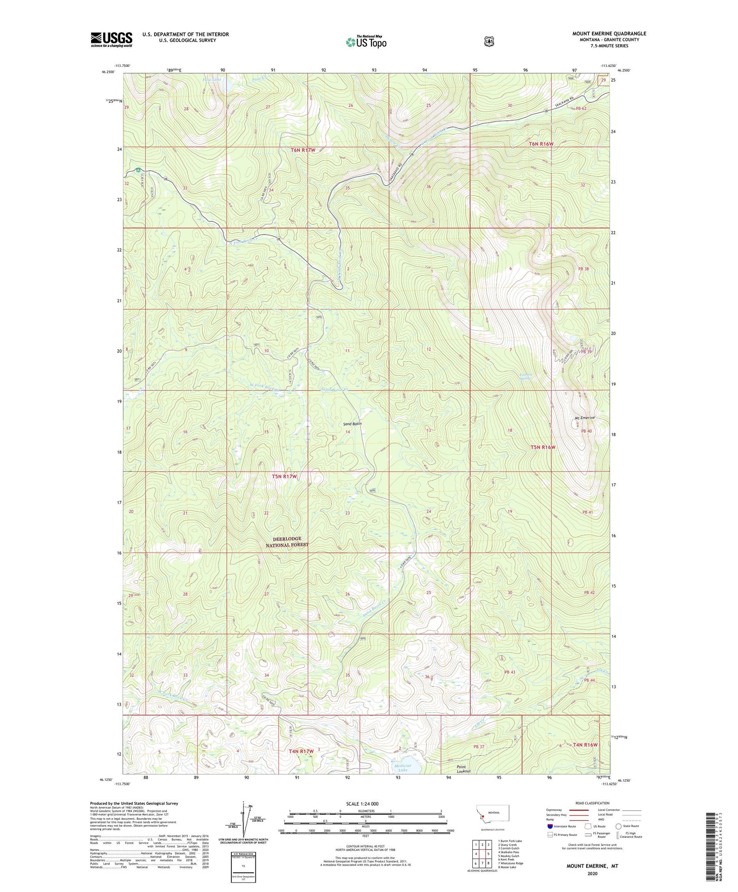
2020 topographic map quadrangle Mount Emerine in the state of Montana. Scale: 1:24000. Based on the newly updated USGS 7.5' US Topo map series, this map is in the following counties: Granite. The map contains contour data, water features, and other items you are used to seeing on USGS maps, but also has updated roads and other features. This is the next generation of topographic maps. Printed on high-quality waterproof paper with UV fade-resistant inks.
Quads adjacent to this one:
West: Skalkaho Pass
Northwest: Burnt Fork Lake
North: Stony Creek
Northeast: Cornish Gulch
East: Maukey Gulch
Southeast: Moose Lake
South: Whetstone Ridge
Southwest: Kent Peak
Contains the following named places: Bowles Creek, Congdon Mine, Crystal Creek, Crystal Creek Campground, Duncie Creek, Emerine Spring, Fuse Creek, Fuse Lake, Medicine Lake, Mount Emerine, North Fork Rock Creek, Sand Basin, Sand Basin Creek


