MyTopo
Mount Headley Montana US Topo Map
Couldn't load pickup availability
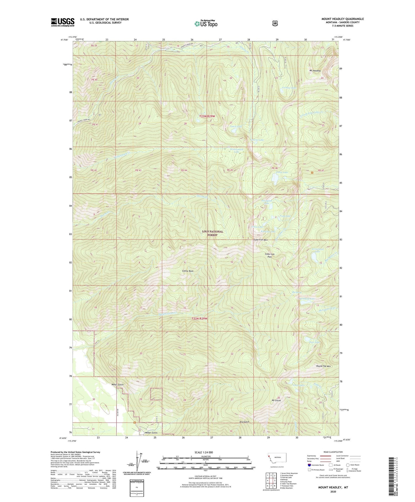
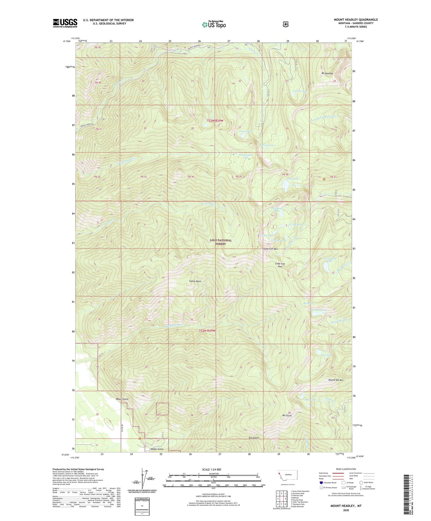
2020 topographic map quadrangle Mount Headley in the state of Montana. Scale: 1:24000. Based on the newly updated USGS 7.5' US Topo map series, this map is in the following counties: Sanders. The map contains contour data, water features, and other items you are used to seeing on USGS maps, but also has updated roads and other features. This is the next generation of topographic maps. Printed on high-quality waterproof paper with UV fade-resistant inks.
Quads adjacent to this one:
West: Belknap
Northwest: Seven Point Mountain
North: Vermilion Peak
Northeast: Fishtrap Lake
East: Priscilla Peak
Southeast: Eddy Mountain
South: Thompson Falls
Southwest: Table Top Mountain
Contains the following named places: Arrowhead Lake, Big Spring, Cabin Lake, Carbine Lake, Castle Rock, Cube Iron Mountain, Cube Iron Pass, Deer Lake, Duckhead Lake, Frog Lake, Goat Lakes, Grass Lake, Graves Lake, Irvs Creek, Knowles Lake, Lawn Lake, Maier Gulch, Mount Headley, Mount Silcox, Porcupine Lake, Round Top Mountain, Weber Gulch, Winniemuck Lake, ZIP Code: 59873