
MyTopo
Mount Maurice Montana US Topo Map
Couldn't load pickup availability
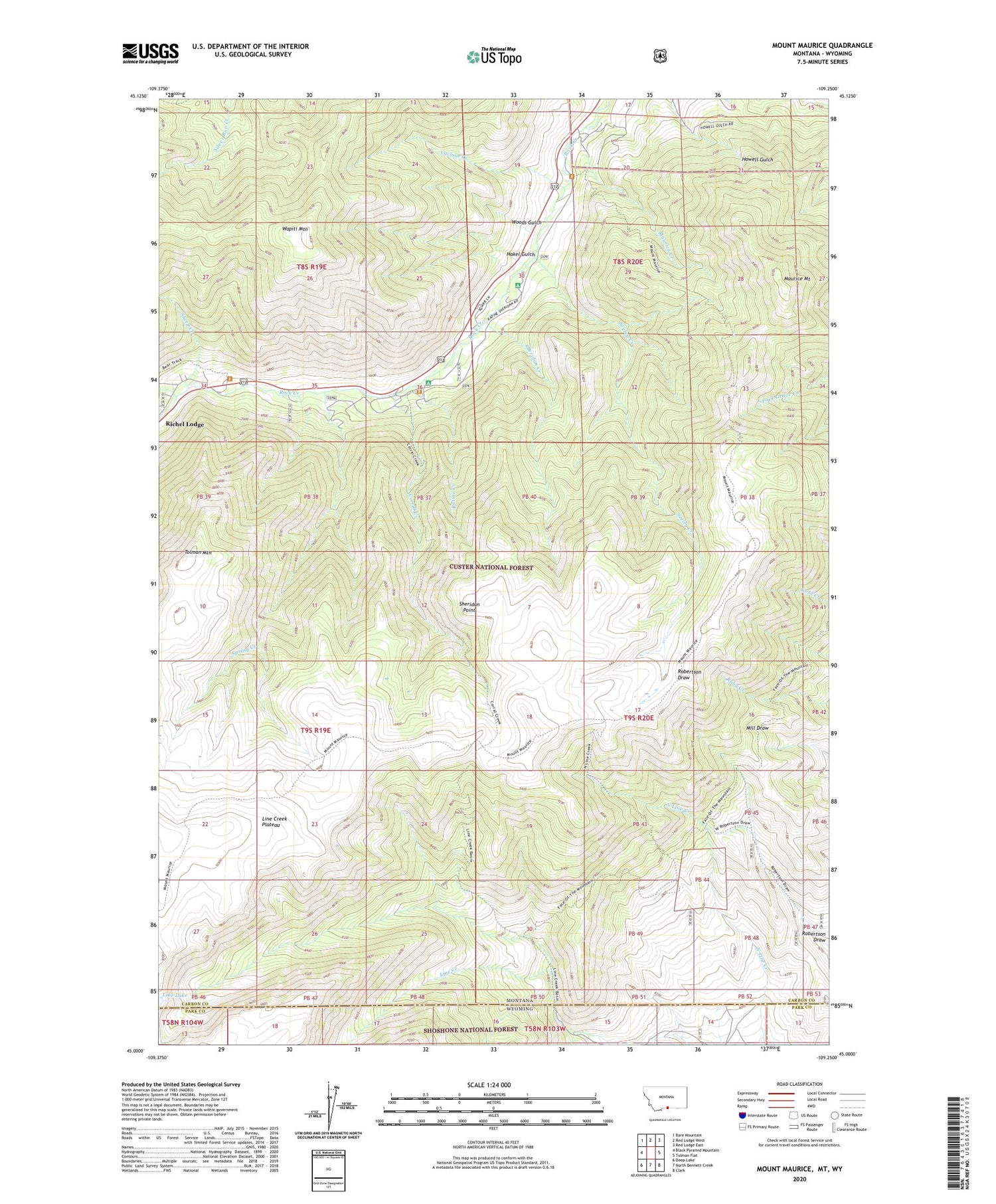
2020 topographic map quadrangle Mount Maurice in the state of Montana. Scale: 1:24000. Based on the newly updated USGS 7.5' US Topo map series, this map is in the following counties: Carbon, Park. The map contains contour data, water features, and other items you are used to seeing on USGS maps, but also has updated roads and other features. This is the next generation of topographic maps. Printed on high-quality waterproof paper with UV fade-resistant inks.
Quads adjacent to this one:
West: Black Pyramid Mountain
Northwest: Bare Mountain
North: Red Lodge West
Northeast: Red Lodge East
East: Tolman Flat
Southeast: Clark
South: North Bennett Creek
Southwest: Deep Lake
Contains the following named places: Camp Miles, Corral Creek, Custer National Forest - Beartooth Division, Custer National Forest Trail, Cyclone Creek, Hakel Gulch, Line Creek Forest Service Station, Line Creek Plateau, Maurice Creek, Maurice Mount, Piney Dell, Ratine Campground, Ratine Creek, Seeley Creek, Sheep Creek, Sheridan Campground, Sheridan Creek, Sheridan Point, Snow Creek, Spring Creek, Tolman Mountain, Wapiti Mountain, Woods Gulch, Yellowstone-Bighorn Research Camp


