MyTopo
Deep Lake Wyoming US Topo Map
Couldn't load pickup availability
Also explore the Deep Lake Forest Service Topo of this same quad for updated USFS data
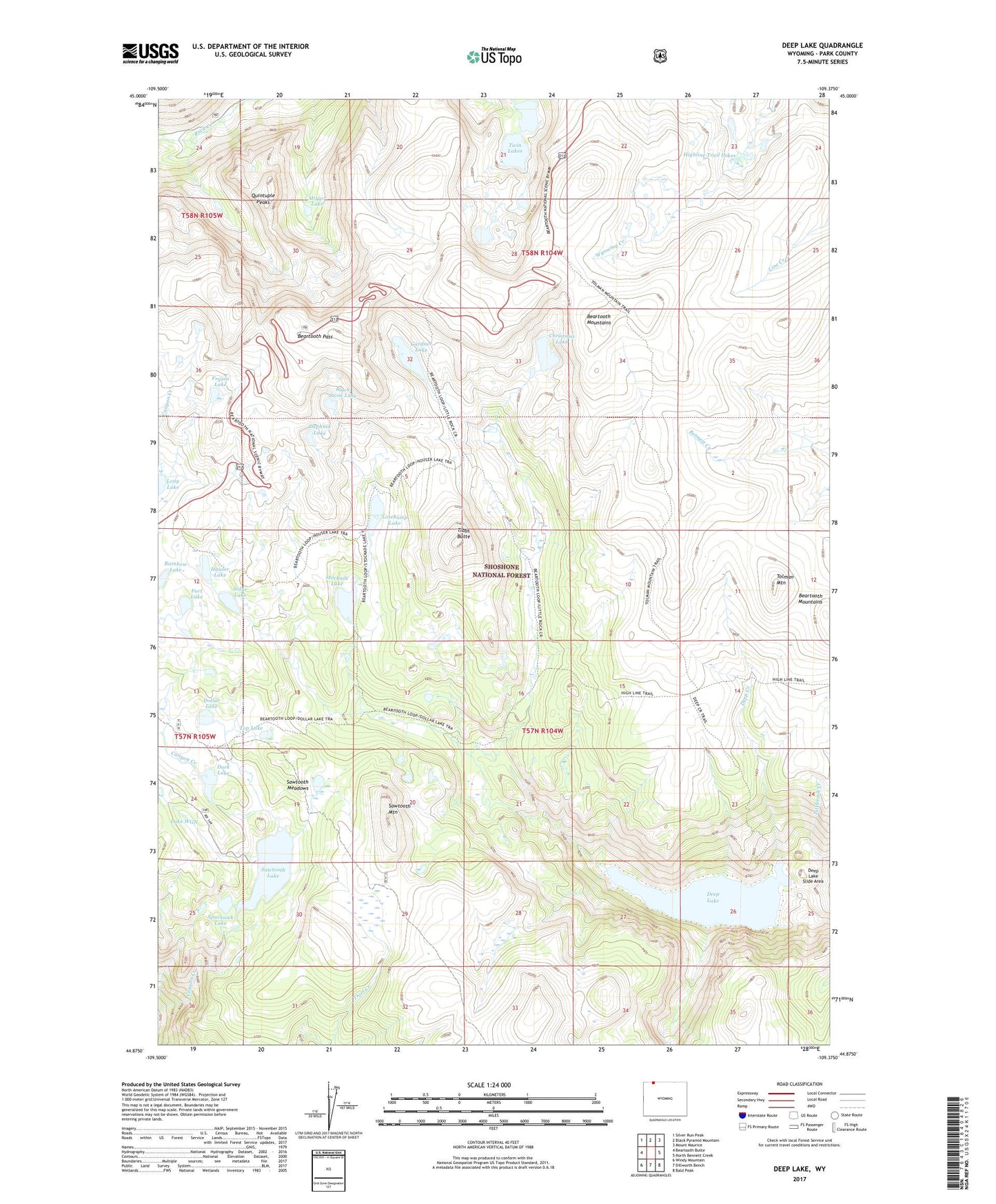
2021 topographic map quadrangle Deep Lake in the state of Wyoming. Scale: 1:24000. Based on the newly updated USGS 7.5' US Topo map series, this map is in the following counties: Park. The map contains contour data, water features, and other items you are used to seeing on USGS maps, but also has updated roads and other features. This is the next generation of topographic maps. Printed on high-quality waterproof paper with UV fade-resistant inks.
Quads adjacent to this one:
West: Beartooth Butte
Northwest: Silver Run Peak
North: Black Pyramid Mountain
Northeast: Mount Maurice
East: North Bennett Creek
Southeast: Bald Peak
South: Dillworth Bench
Southwest: Windy Mountain
This map covers the same area as the classic USGS quad with code o44109h4.
Contains the following named places: Beartooth Loop National Recreation Trail, Beartooth Pass, Black Stone Lake, Camp Sawtooth, Christmas Lake, Daphnia Lake, Deep Creek, Deep Lake, Deep Lake Slide Area, Dollar Lake, Duck Lake, Fort Lake, Frozen Lake, Gardner Lake, Hauser Lake, Highline Trail Lakes, Lake WGN, Losekamp Lake, Mirror Lake, Quintuple Peaks, Sawtooth Lake, Sawtooth Meadows, Sawtooth Mountain, Solar Lake, Sparhawk Lake, Stockade Lake, Tibbs Butte, Tibbs Butte Mine, Tolman Mountain, Top Lake, Twin Lakes