MyTopo
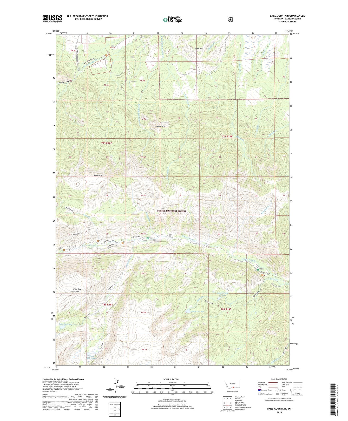
Bare Mountain Montana US Topo Map
Couldn't load pickup availability
Also explore the Bare Mountain Forest Service Topo of this same quad for updated USFS data
2024 topographic map quadrangle Bare Mountain in the state of Montana. Scale: 1:24000. Based on the newly updated USGS 7.5' US Topo map series, this map is in the following counties: Carbon. The map contains contour data, water features, and other items you are used to seeing on USGS maps, but also has updated roads and other features. This is the next generation of topographic maps. Printed on high-quality waterproof paper with UV fade-resistant inks.
Quads adjacent to this one:
West: Sylvan Peak
Northwest: Mackay Ranch
North: Roscoe
Northeast: Castagne
East: Red Lodge West
Southeast: Mount Maurice
South: Black Pyramid Mountain
Southwest: Silver Run Peak
This map covers the same area as the classic USGS quad with code o45109b4.
Contains the following named places: Bare Mountain, Basin Campground, Basin Creek Lake, Blacktail Creek, Bots Sots Campground, Burnt Mountain, Camp Senia, Cascade Campground, Cascade Creek, Lake Gertrude, Lower Basin Creek Lake, Nelson Campground, Red Lodge Division, Senia Creek, Sheep Mountain, Silver Run Lakes, Timberline Creek