MyTopo
Pine View Montana US Topo Map
Couldn't load pickup availability
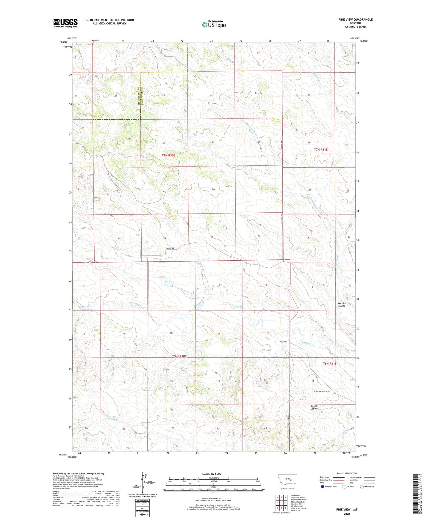
2024 topographic map quadrangle Pine View in the state of Montana. Scale: 1:24000. Based on the newly updated USGS 7.5' US Topo map series, this map is in the following counties: Yellowstone, Musselshell. The map contains contour data, water features, and other items you are used to seeing on USGS maps, but also has updated roads and other features. This is the next generation of topographic maps. Printed on high-quality waterproof paper with UV fade-resistant inks.
Quads adjacent to this one:
West: Steamboat Butte
Northwest: Corey Flat
North: Chandler Spring
Northeast: Weed Creek West
East: Mailbox Hill
Southeast: Mud Butte
South: Bull Mountain NW
Southwest: P K Ranch NE
This map covers the same area as the classic USGS quad with code o46107c8.
Contains the following named places: 06N30E01____01 Well, 06N30E03BBDC01 Well, 06N30E05DDAC01 Well, 06N30E10DBAC01 Well, 06N30E10DBAC02 Well, 07N30E33CADB01 Well, 07N30E34CBCB01 Well, Brown Buffalo Number 1 Dam, Donalds Coulee, Jones Dam, Pine View