MyTopo
Nixon Gulch Montana US Topo Map
Couldn't load pickup availability
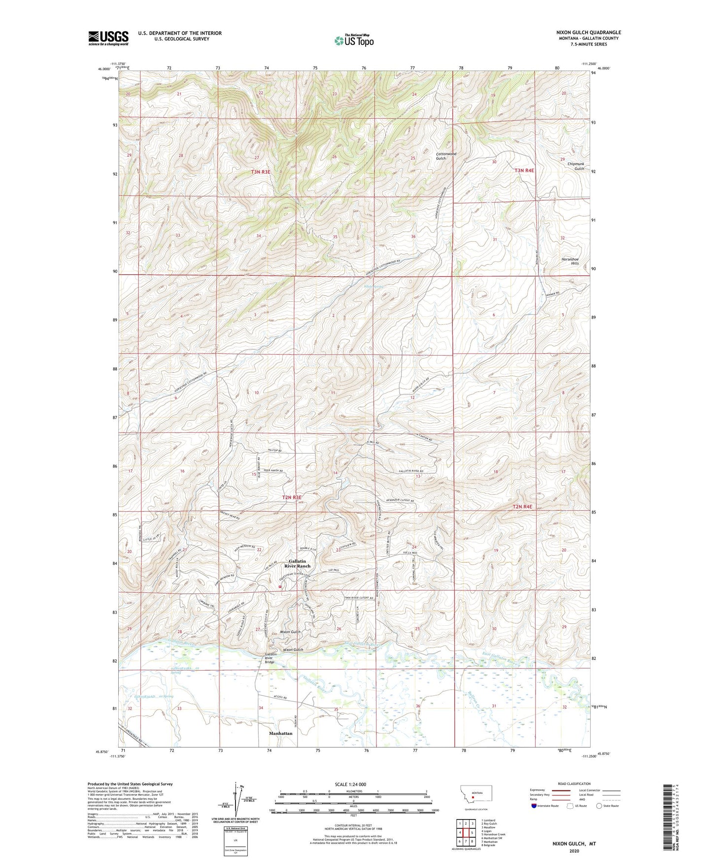
2024 topographic map quadrangle Nixon Gulch in the state of Montana. Scale: 1:24000. Based on the newly updated USGS 7.5' US Topo map series, this map is in the following counties: Gallatin. The map contains contour data, water features, and other items you are used to seeing on USGS maps, but also has updated roads and other features. This is the next generation of topographic maps. Printed on high-quality waterproof paper with UV fade-resistant inks.
Quads adjacent to this one:
West: Logan
Northwest: Lombard
North: Roy Gulch
Northeast: Maudlow
East: Horseshoe Creek
Southeast: Belgrade
South: Manhattan
Southwest: Manhattan SW
This map covers the same area as the classic USGS quad with code o45111h3.
Contains the following named places: 02N03E25CB__01 Well, 02N03E32AD__01 Spring, 02N03E32DD__01 Well, 02N03E33BA__01 Spring, 02N03E33DADD01 Well, 02N03E34CA__01 Well, 02N03E34DD__01 Well, 02N03E36AC__01 Well, 02N04E31CC__01 Well, 02N04E32AB__01 Well, Barton Bridge, Bullrun Creek, Camp Creek, East Gallatin River, Gallatin Forks Fishing Access Site, Gallatin River Bridge, Gallatin River Ranch Census Designated Place, Gallatin River Ranch Rural Fire Department, Horseshoe/Nixon Glch Mine, Lockhart Ranch, Mixon Gulch, Mount Zion School, Nixon Gulch, White Spring