MyTopo
Roy Gulch Montana US Topo Map
Couldn't load pickup availability
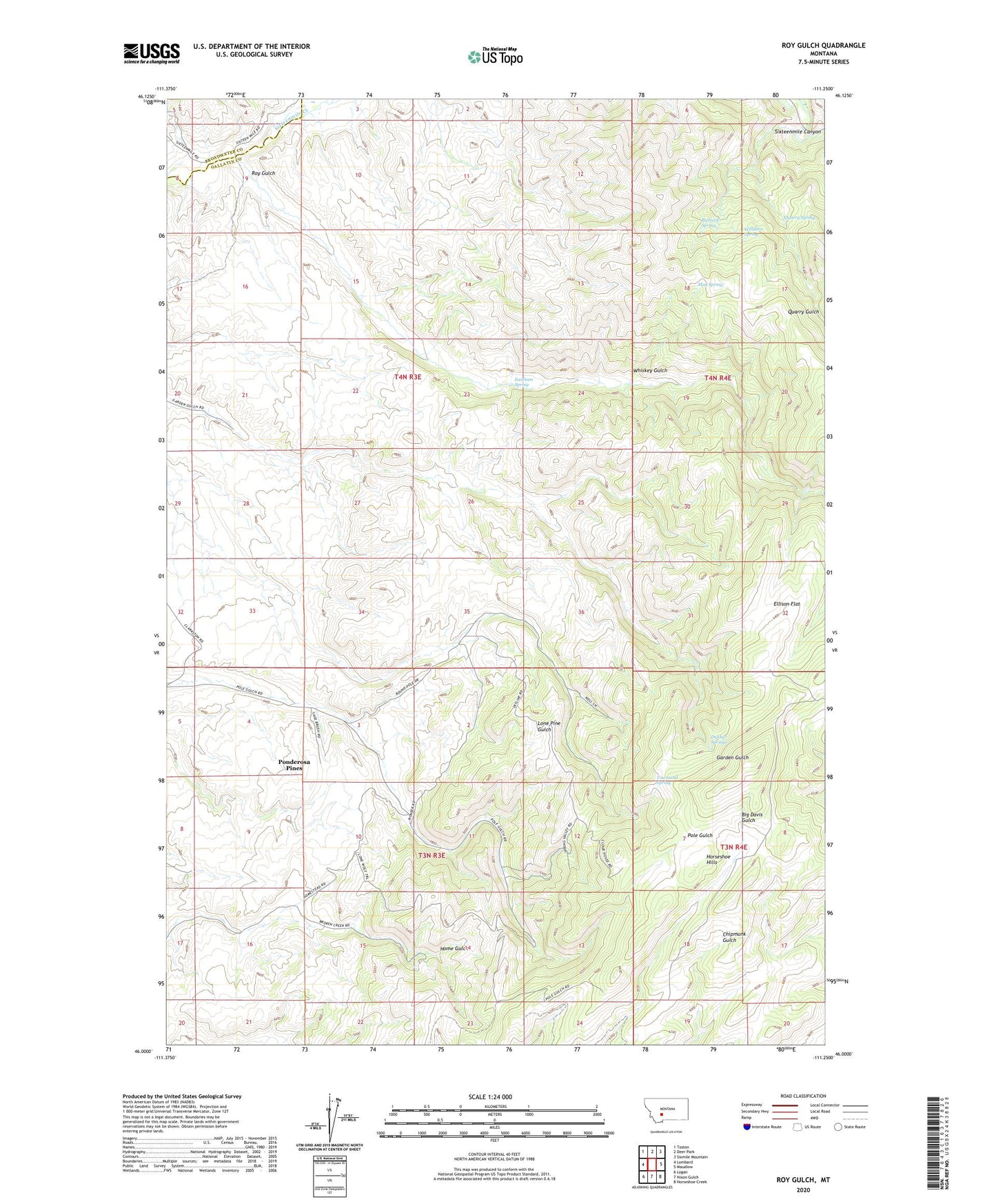
2024 topographic map quadrangle Roy Gulch in the state of Montana. Scale: 1:24000. Based on the newly updated USGS 7.5' US Topo map series, this map is in the following counties: Gallatin, Broadwater. The map contains contour data, water features, and other items you are used to seeing on USGS maps, but also has updated roads and other features. This is the next generation of topographic maps. Printed on high-quality waterproof paper with UV fade-resistant inks.
Quads adjacent to this one:
West: Lombard
Northwest: Toston
North: Deer Park
Northeast: Sixmile Mountain
East: Maudlow
Southeast: Horseshoe Creek
South: Nixon Gulch
Southwest: Logan
This map covers the same area as the classic USGS quad with code o46111a3.
Contains the following named places: Bullrock Spring, Cardinal, Dunbar Springs, Eastham Spring, Ellison Flat, Garden Gulch School, Horseshoe Hills, Mud Spring, Ponderosa Pines Census Designated Place, Quarry Gulch, Quarry Spring, Round Pole Corrals, Roy Gulch, Townsend Spring, Whiskey Gulch, Williams Spring