MyTopo
North Lothair School Montana US Topo Map
Couldn't load pickup availability
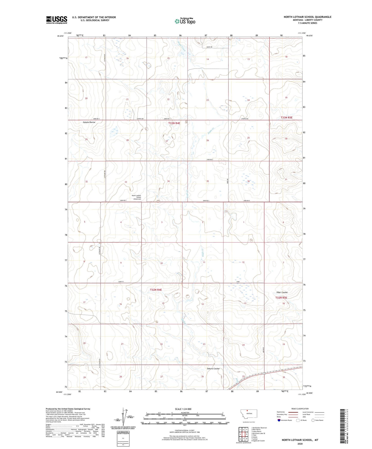
2020 topographic map quadrangle North Lothair School in the state of Montana. Scale: 1:24000. Based on the newly updated USGS 7.5' US Topo map series, this map is in the following counties: Liberty. The map contains contour data, water features, and other items you are used to seeing on USGS maps, but also has updated roads and other features. This is the next generation of topographic maps. Printed on high-quality waterproof paper with UV fade-resistant inks.
Quads adjacent to this one:
West: McCarters Lake SE
Northwest: Berkholder Reservoir
North: Blair Ranch
Northeast: Lakey Ranch
East: Tiber
Southeast: Sagebrush Coulee
South: Lothair
Southwest: Galata
Contains the following named places: 32N04E13DADB01 Well, Briggs Post Office, Laas Dam, North Lothair School, Sekora Coulee, Utopia Gas and Oil Field