MyTopo
Lakey Ranch Montana US Topo Map
Couldn't load pickup availability
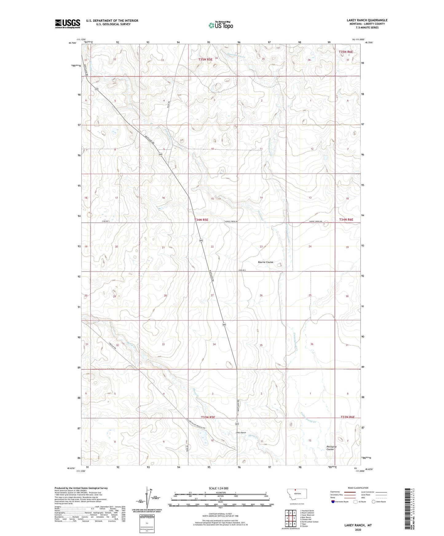
2024 topographic map quadrangle Lakey Ranch in the state of Montana. Scale: 1:24000. Based on the newly updated USGS 7.5' US Topo map series, this map is in the following counties: Liberty. The map contains contour data, water features, and other items you are used to seeing on USGS maps, but also has updated roads and other features. This is the next generation of topographic maps. Printed on high-quality waterproof paper with UV fade-resistant inks.
Quads adjacent to this one:
West: Blair Ranch
Northwest: Haystack Butte
North: Mount Lebanon
Northeast: Vaver Reservoir
East: Chester NW
Southeast: Chester
South: Tiber
Southwest: North Lothair School
This map covers the same area as the classic USGS quad with code o48111f1.
Contains the following named places: 33N05E01CDDC01 Well, 34N05E14ADAC01 Well, 34N05E24DAAA01 Well, 34N05E25ABBB01 Well, 34N05E35AAAB01 Well, 34N05E36ABBB01 Well, 34N06E30BABB01 Well, Bourne Coulee, Corral Creek, Government Creek, Hawks Ranch, Lakey Ranch, Lyders Ranch, Phillipine Coulee, Ploss Ranch, Reiland Ranch, Skari Ranch, Thieltge Ranch, Wardell Ranch