
MyTopo
Oswego Montana US Topo Map
Couldn't load pickup availability
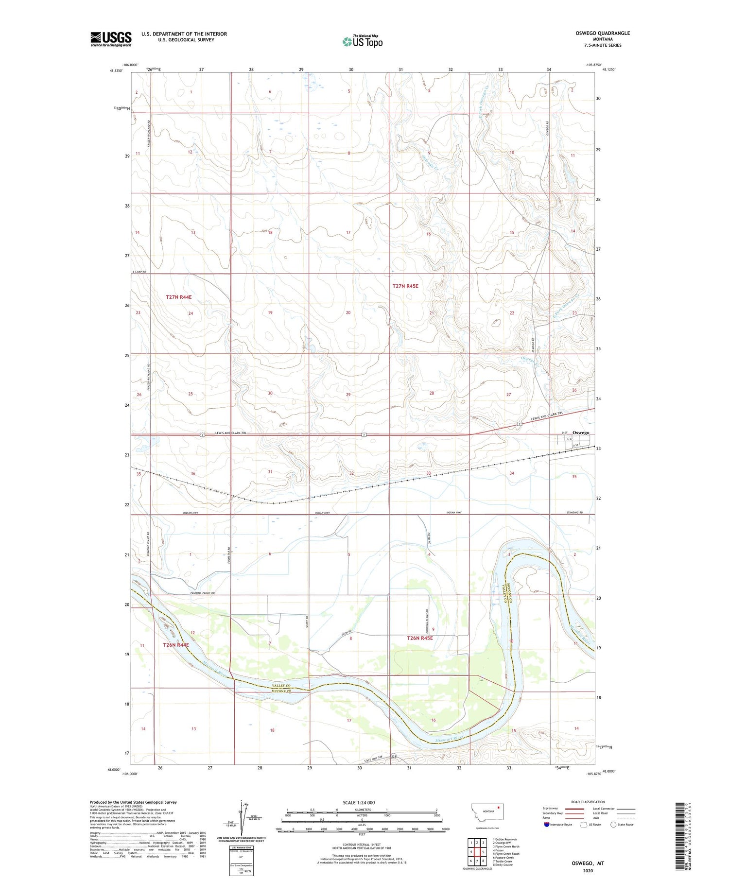
2020 topographic map quadrangle Oswego in the state of Montana. Scale: 1:24000. Based on the newly updated USGS 7.5' US Topo map series, this map is in the following counties: Valley, McCone. The map contains contour data, water features, and other items you are used to seeing on USGS maps, but also has updated roads and other features. This is the next generation of topographic maps. Printed on high-quality waterproof paper with UV fade-resistant inks.
Quads adjacent to this one:
West: Frazer
Northwest: Dubbe Reservoir
North: Oswego NW
Northeast: Flynn Creek North
East: Flynn Creek South
Southeast: Emily Coulee
South: Turtle Creek
Southwest: Pasture Creek
Contains the following named places: 26N44E01AA__01 Well, 26N44E01CD__01 Well, 26N44E01DA__01 Well, 26N44E01DC__01 Well, 26N44E01DD__01 Well, 26N44E02DA__01 Well, 26N44E11AD__01 Well, 26N44E11AD__02 Well, 26N44E12AA__01 Well, 26N44E12BC__01 Well, 26N44E12CC__01 Well, 26N44E13AA__01 Well, 26N44E13BA__01 Well, 26N44E13BB__01 Well, 26N44E13CA__01 Well, 26N44E13DA__01 Well, 26N44E13DD__01 Well, 26N44E14AA__02 Well, 26N44E14AAAA01 Well, 26N44E14AAAC01 Well, 26N44E14DA__01 Well, 26N44E14DA__02 Well, 26N45E02BB__01 Well, 26N45E03AA__01 Well, 26N45E03BC__01 Well, 26N45E03CB__01 Well, 26N45E04BC__01 Well, 26N45E04CB__01 Well, 26N45E04CC__01 Well, 26N45E04DC__01 Well, 26N45E04DD__01 Well, 26N45E05AB__01 Well, 26N45E05ABBB01 Well, 26N45E05AD__01 Well, 26N45E05CB__01 Well, 26N45E05DD__01 Well, 26N45E06AA__01 Well, 26N45E06BD__01 Well, 26N45E07AC__01 Well, 26N45E07AD__01 Well, 26N45E08CC__01 Well, 26N45E08CC__02 Well, 26N45E09AC__01 Well, 26N45E09DB__01 Well, 26N45E10DDAC01 Well, 26N45E17BC__01 Well, 26N45E17CB__01 Well, 26N45E17CD__01 Well, 26N45E18AA__01 Well, 26N45E18AC__01 Well, 26N45E18AC__02 Well, 26N45E18AD__01 Well, 26N45E18DBBA01 Well, 27N44E14DD__01 Well, 27N44E35DD__01 Well, 27N45E11BC__01 Well, 27N45E11CBBA01 Well, 27N45E31DDDA01 Well, 27N45E32DD__01 Well, 27N45E33CC__01 Well, 27N45E33CD__01 Well, 27N45E33DC__01 Well, 27N45E34CD__01 Well, 27N45E34DD__01 Well, 27N45E35BA__01 Well, 27N45E35BA__02 Well, 27N45E35CB__01 Well, Don Number 1 Dam, East Fork Oswego Creek, Fort Peck Reservation Number 12 Dam, Imperial Elevator, Lambetts, Main Canal, Oswego, Oswego Elevator, Oswego Post Office, Smith-Tyner Elevator


