MyTopo
Flynn Creek North Montana US Topo Map
Couldn't load pickup availability
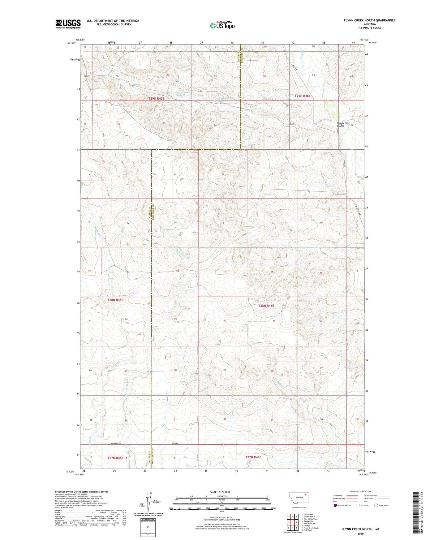
2024 topographic map quadrangle Flynn Creek North in the state of Montana. Scale: 1:24000. Based on the newly updated USGS 7.5' US Topo map series, this map is in the following counties: Roosevelt, Valley. The map contains contour data, water features, and other items you are used to seeing on USGS maps, but also has updated roads and other features. This is the next generation of topographic maps. Printed on high-quality waterproof paper with UV fade-resistant inks.
Quads adjacent to this one:
West: Oswego NW
Northwest: Todd Lakes
North: Todd Lakes SE
Northeast: Tule Valley West
East: Wolf Point NW
Southeast: Wolf Point
South: Flynn Creek South
Southwest: Oswego
This map covers the same area as the classic USGS quad with code o48105b7.
Contains the following named places: 27N46E06BB__01 Well, 28N46E02BBCB01 Well, 28N46E05CBCA01 Well, 28N46E05DDAD01 Well, 28N46E06BAAC01 Well, 28N46E09ABBC01 Well, 28N46E10BBBB01 Well, 28N46E18AADD01 Well, 28N46E32BCCC01 Well, 29N45E26DCDD01 Spring, 29N45E36BAAA01 Spring, Badger Hole Coulee, Kohl School, Marmon School, Warmbrod School