MyTopo
Flynn Creek South Montana US Topo Map
Couldn't load pickup availability
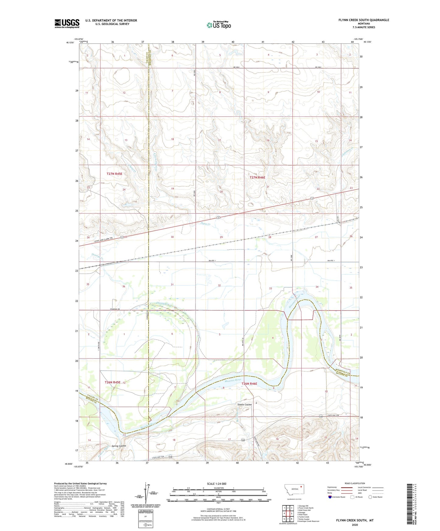
2024 topographic map quadrangle Flynn Creek South in the state of Montana. Scale: 1:24000. Based on the newly updated USGS 7.5' US Topo map series, this map is in the following counties: Roosevelt, Valley, McCone. The map contains contour data, water features, and other items you are used to seeing on USGS maps, but also has updated roads and other features. This is the next generation of topographic maps. Printed on high-quality waterproof paper with UV fade-resistant inks.
Quads adjacent to this one:
West: Oswego
Northwest: Oswego NW
North: Flynn Creek North
Northeast: Wolf Point NW
East: Wolf Point
Southeast: Antelope Creek Reservoir
South: Emily Coulee
Southwest: Turtle Creek
This map covers the same area as the classic USGS quad with code o48105a7.
Contains the following named places: 26N45E01AB__01 Well, 26N45E01BB__01 Well, 26N45E01CB__01 Well, 26N45E01CC__01 Well, 26N45E01CD__01 Well, 26N45E02AC__01 Well, 26N45E02AD__01 Well, 26N45E11AC__01 Well, 26N45E11DCCD01 Well, 26N46E02BB__01 Well, 26N46E03CDDC01 Well, 26N46E05DB__01 Well, 26N46E05DD__01 Well, 26N46E06CA__01 Well, 26N46E09CC__01 Well, 26N46E10BA__01 Well, 26N46E10BB__01 Well, 26N46E10CA__01 Well, 26N46E14CB__01 Well, 26N46E18CD__01 Well, 27N45E36BB__01 Well, 27N45E36BCC_01 Well, 27N45E36CCCC01 Well, 27N45E36DC__01 Well, 27N46E07BB__01 Well, 27N46E20CD__01 Well, 27N46E26BC__01 Well, 27N46E26CD__01 Well, 27N46E27AD__01 Well, 27N46E27CB__01 Well, 27N46E28BA__01 Well, 27N46E28BB__01 Well, 27N46E28DA__01 Well, 27N46E28DA__02 Well, 27N46E30AADB01 Well, 27N46E30DD__01 Well, 27N46E31BA__01 Well, 27N46E31BB__01 Well, 27N46E31CB__01 Well, 27N46E32BBA_01 Well, 27N46E32BC__01 Well, 27N46E33AA__01 Well, 27N46E33BA__01 Well, 27N46E33CA__01 Well, 27N46E34CA__01 Well, Box Elder Creek, Day School, East Fork Flynn Creek, Flynn Creek, Gass Reservoir Dam, Lohmiller, Oswego Church, Oswego Creek, Oswego School, Pearmond, Pearmond Post Office, Prairie Elk Colony, Prairie Elk Colony Census Designated Place, Prairie Elk Creek, Spring Coulee, Steele Coulee, Warmbrod Dam