MyTopo
Anderson Bridge Montana US Topo Map
Couldn't load pickup availability
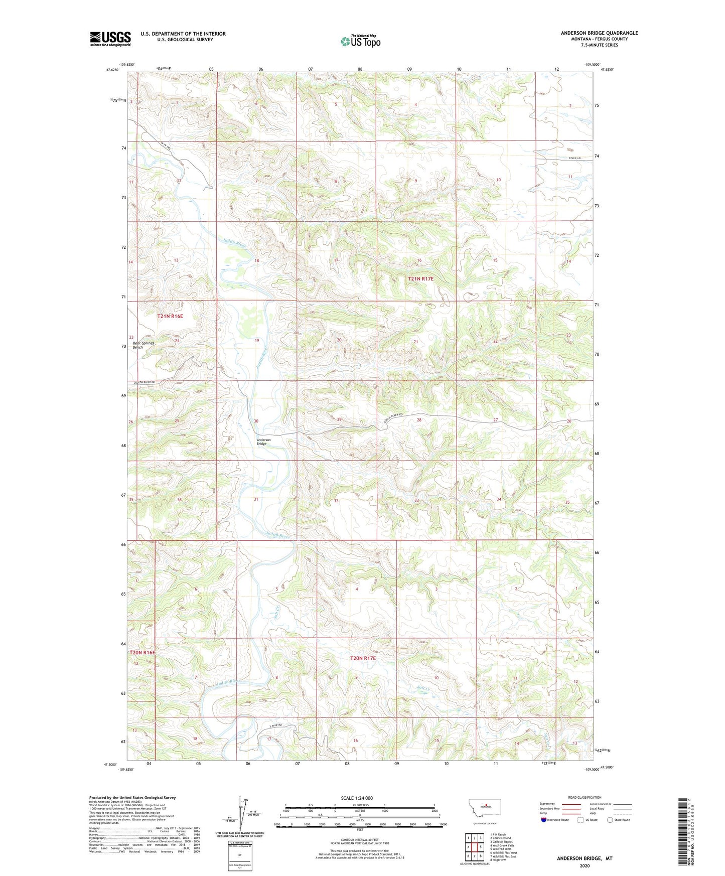
2024 topographic map quadrangle Anderson Bridge in the state of Montana. Scale: 1:24000. Based on the newly updated USGS 7.5' US Topo map series, this map is in the following counties: Fergus. The map contains contour data, water features, and other items you are used to seeing on USGS maps, but also has updated roads and other features. This is the next generation of topographic maps. Printed on high-quality waterproof paper with UV fade-resistant inks.
Quads adjacent to this one:
West: Wolf Creek Falls
Northwest: P N Ranch
North: Council Island
Northeast: Gallatin Rapids
East: Winifred West
Southeast: Hilger NW
South: Wild Bill Flat East
Southwest: Wild Bill Flat West
This map covers the same area as the classic USGS quad with code o47109e5.
Contains the following named places: 21N17E30BDBA01 Well, 21N17E30DBDB01 Well, Anderson Bridge, Anderson Coulee, Brown Coulee, Fullerton Post Office, Paradise Heights School, Salt Creek