MyTopo
Padlock Ranch Montana US Topo Map
Couldn't load pickup availability
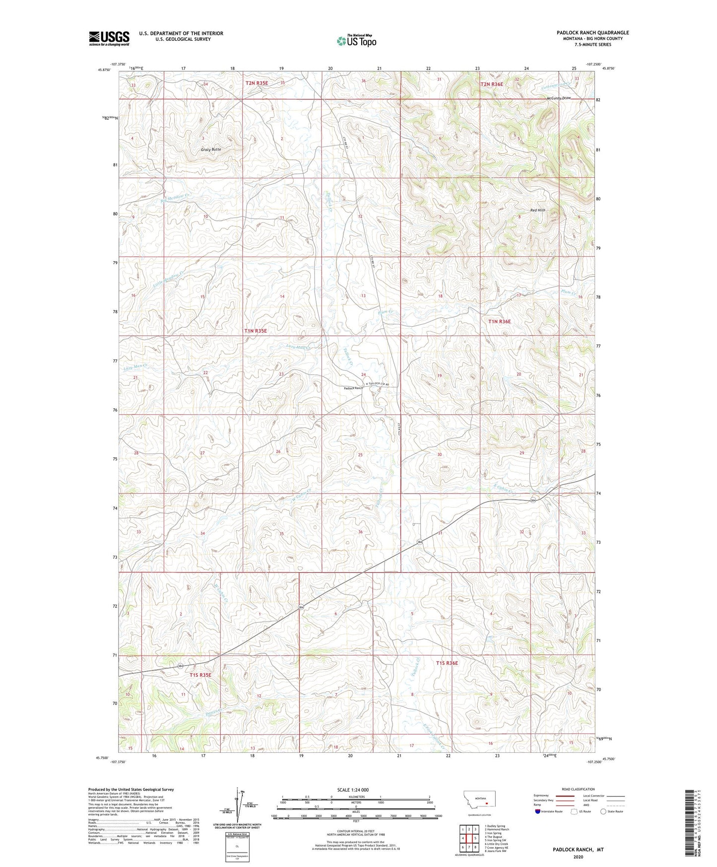
2024 topographic map quadrangle Padlock Ranch in the state of Montana. Scale: 1:24000. Based on the newly updated USGS 7.5' US Topo map series, this map is in the following counties: Big Horn. The map contains contour data, water features, and other items you are used to seeing on USGS maps, but also has updated roads and other features. This is the next generation of topographic maps. Printed on high-quality waterproof paper with UV fade-resistant inks.
Quads adjacent to this one:
West: The Dugout
Northwest: Dudley Spring
North: Hammond Ranch
Northeast: Iron Spring
East: Iron Spring SW
Southeast: Jeans Fork NW
South: Crow Agency NE
Southwest: Little Dry Creek
This map covers the same area as the classic USGS quad with code o45107g3.
Contains the following named places: 01N35E24DBCA01 Well, 01N36E30BDDA01 Well, 01S36E03ADBD01 Well, 01S36E10BDDA01 Well, 02N35E35DCAA01 Well, Big Meadow Creek, Dawes Creek, East Cabin Creek, East Fork Tullock Creek, Gracy Butte, Lazy Man Creek, Little Meadow Creek, Padlock Ranch, Plum Creek, Red Hills, West Cabin Creek