
MyTopo
Penrose Peak Montana US Topo Map
Couldn't load pickup availability
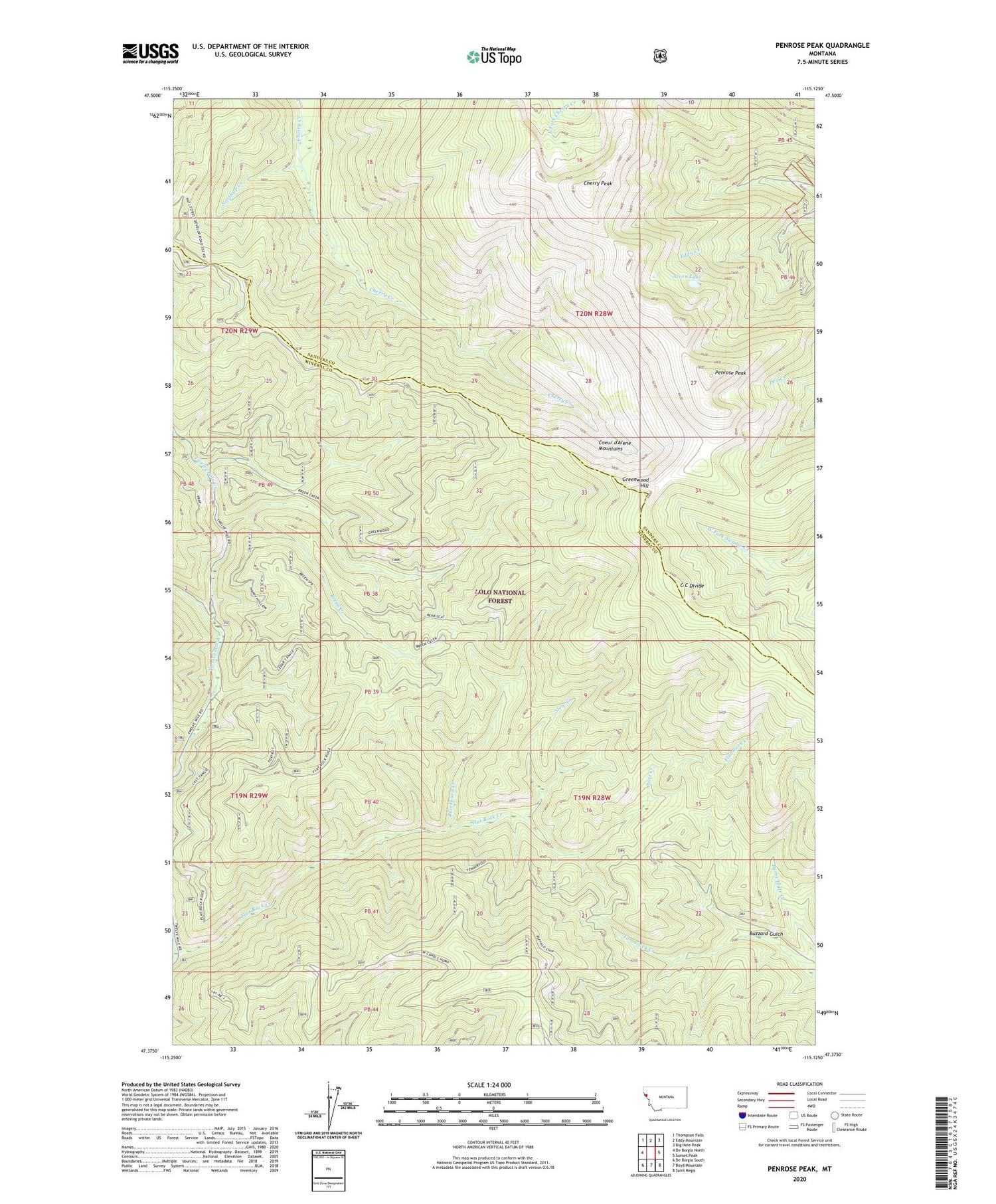
2020 topographic map quadrangle Penrose Peak in the state of Montana. Scale: 1:24000. Based on the newly updated USGS 7.5' US Topo map series, this map is in the following counties: Mineral, Sanders. The map contains contour data, water features, and other items you are used to seeing on USGS maps, but also has updated roads and other features. This is the next generation of topographic maps. Printed on high-quality waterproof paper with UV fade-resistant inks.
Quads adjacent to this one:
West: De Borgia North
Northwest: Thompson Falls
North: Eddy Mountain
Northeast: Big Hole Peak
East: Sunset Peak
Southeast: Saint Regis
South: Boyd Mountain
Southwest: De Borgia South
Contains the following named places: Acorn Lake, Annie Lorie Number 1 Mine, Blackburn Creek, Breen Creek, Burnt Flats Creek, Buzzard Gulch, C C Divide, Cherry Peak, Coeur d'Alene Mountains, Flat Rock Creek, Flat Rock Lookout Station, Greenwood Hill, Mineral Mountain Creek, Northup Creek, Penrose Peak, Short Creek, Slow Creek, Upper Eddy Creek Mine


