MyTopo
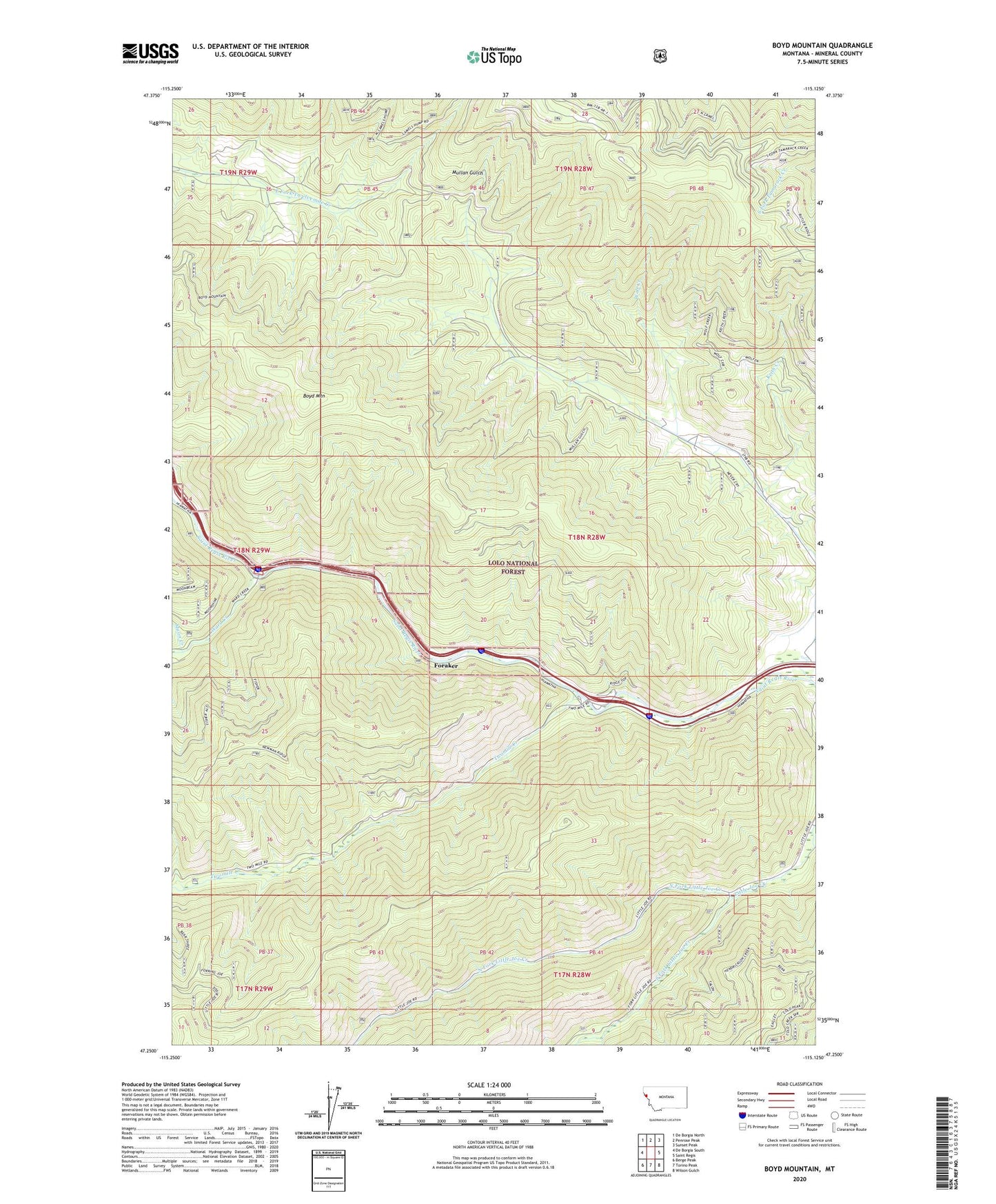
Boyd Mountain Montana US Topo Map
Couldn't load pickup availability
Also explore the Boyd Mountain Forest Service Topo of this same quad for updated USFS data
2024 topographic map quadrangle Boyd Mountain in the state of Montana. Scale: 1:24000. Based on the newly updated USGS 7.5' US Topo map series, this map is in the following counties: Mineral. The map contains contour data, water features, and other items you are used to seeing on USGS maps, but also has updated roads and other features. This is the next generation of topographic maps. Printed on high-quality waterproof paper with UV fade-resistant inks.
Quads adjacent to this one:
West: De Borgia South
Northwest: De Borgia North
North: Penrose Peak
Northeast: Sunset Peak
East: Saint Regis
Southeast: Wilson Gulch
South: Torino Peak
Southwest: Berge Peak
This map covers the same area as the classic USGS quad with code o47115c2.
Contains the following named places: Boyd Mountain, Buford, Buford School, Camels Hump Lookout Station, Foraker, Keith Creek, Keith Creek Mine, Little Joe Lookout Station, Little Saint Joe, Moon Creek, North Fork Little Joe Creek, South Fork Little Joe Creek, Twomile Creek, Twomile Pond, Ward Creek, Wolf Creek, Wolf Creek Mine, ZIP Code: 59866