MyTopo
Peterson Lake Montana US Topo Map
Couldn't load pickup availability
Also explore the Peterson Lake Forest Service Topo of this same quad for updated USFS data
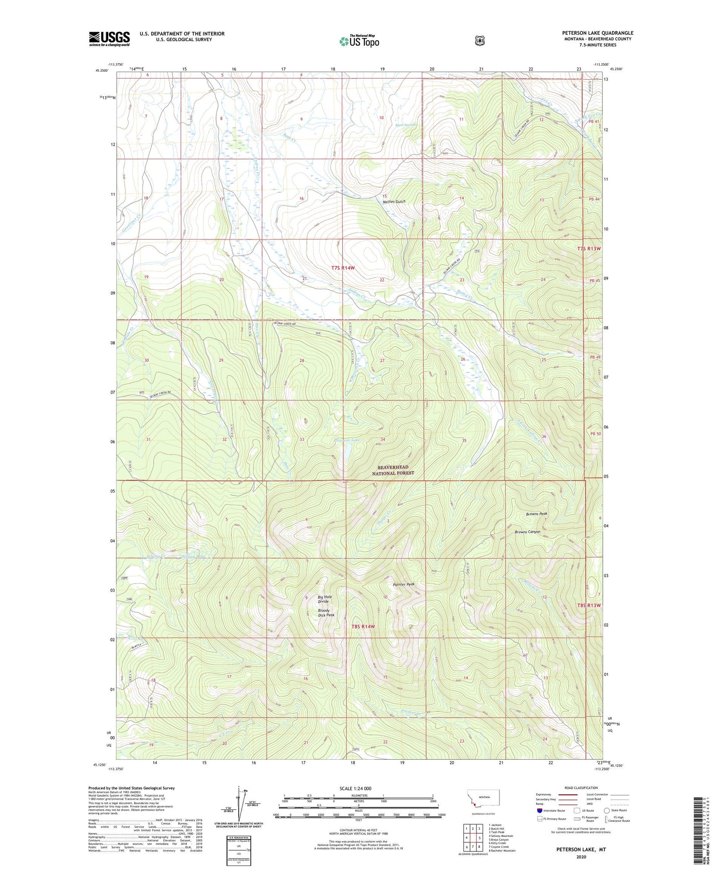
2024 topographic map quadrangle Peterson Lake in the state of Montana. Scale: 1:24000. Based on the newly updated USGS 7.5' US Topo map series, this map is in the following counties: Beaverhead. The map contains contour data, water features, and other items you are used to seeing on USGS maps, but also has updated roads and other features. This is the next generation of topographic maps. Printed on high-quality waterproof paper with UV fade-resistant inks.
Quads adjacent to this one:
West: Selway Mountain
Northwest: Jackson
North: Butch Hill
Northeast: Tash Peak
East: Brays Canyon
Southeast: Bachelor Mountain
South: Coyote Creek
Southwest: Kitty Creek
This map covers the same area as the classic USGS quad with code o45113b3.
Contains the following named places: Alice Cabin, Bailey Creek, Big Hole Divide, Bloody Dick Peak, Browns Peak, Inabnit Peterson Ditch, Indian Creek, Nellies Gulch, North Fork Fox Creek, Painter Peak, Peterson Creek, Peterson Lake, Pine Creek, Ryan Springs, Selway Lake, South Fork Andrus Creek, South Fork Fox Creek, Thayer Cabin, Thayer Creek