MyTopo
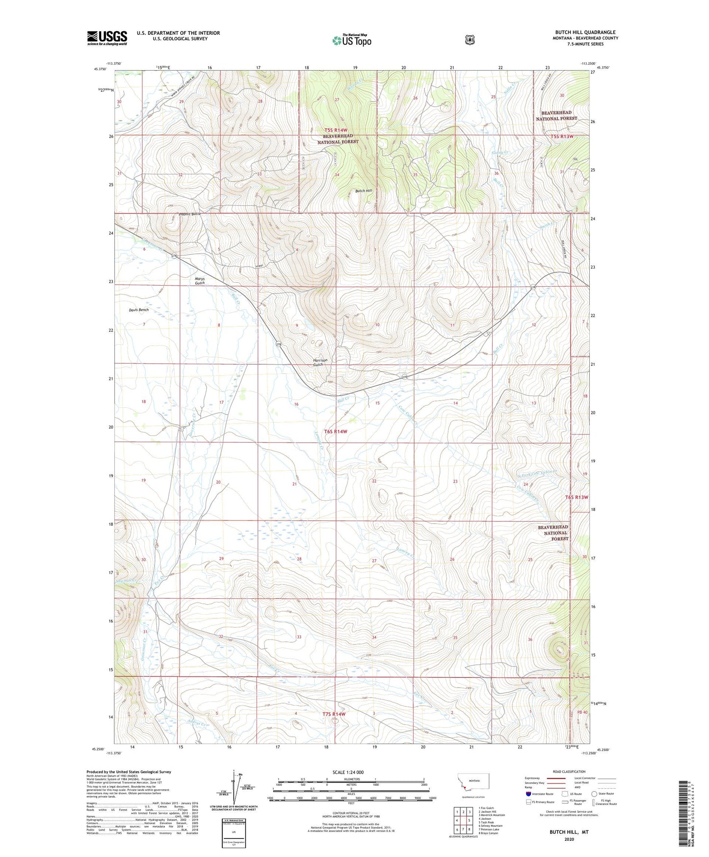
Butch Hill Montana US Topo Map
Couldn't load pickup availability
Also explore the Butch Hill Forest Service Topo of this same quad for updated USFS data
2024 topographic map quadrangle Butch Hill in the state of Montana. Scale: 1:24000. Based on the newly updated USGS 7.5' US Topo map series, this map is in the following counties: Beaverhead. The map contains contour data, water features, and other items you are used to seeing on USGS maps, but also has updated roads and other features. This is the next generation of topographic maps. Printed on high-quality waterproof paper with UV fade-resistant inks.
Quads adjacent to this one:
West: Jackson
Northwest: Fox Gulch
North: Jackson Hill
Northeast: Maverick Mountain
East: Tash Peak
Southeast: Brays Canyon
South: Peterson Lake
Southwest: Selway Mountain
This map covers the same area as the classic USGS quad with code o45113c3.
Contains the following named places: 06S14W17CBDD01 Well, 06S14W17CCAB01 Well, 59736, Andrus Creek, Bull Creek, Butch Hill, Cow Cabin Creek, Davis Bench, Davis Ditch, Fox Creek, Ginny Creek, Gloss Place, Hairpin Ranch, Harrison Gulch, Inabnit Butte, Lancey Creek, Main Jackson Ditch, Marys Gulch, Nellie Creek, North Fork Cow Cabin Creek, Prines Cabin, Prines Ditch, Sage Creek, Sawmill Creek, Smith Creek, Spencer Ditch, Tebo Ditch Number 13, Upper Fox Creek Ditch, Wengers Ditch