MyTopo
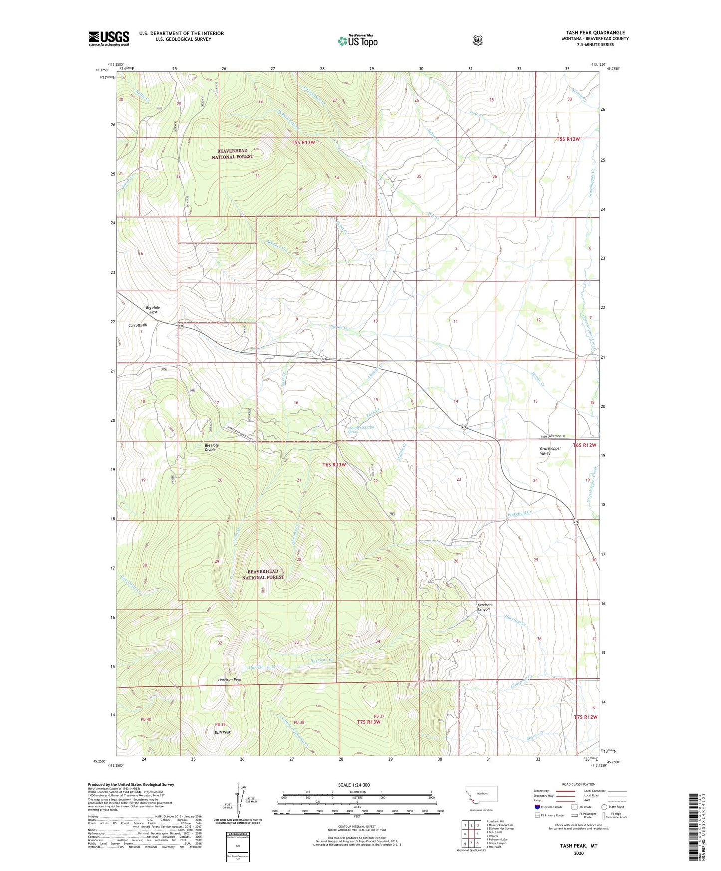
Tash Peak Montana US Topo Map
Couldn't load pickup availability
Also explore the Tash Peak Forest Service Topo of this same quad for updated USFS data
2024 topographic map quadrangle Tash Peak in the state of Montana. Scale: 1:24000. Based on the newly updated USGS 7.5' US Topo map series, this map is in the following counties: Beaverhead. The map contains contour data, water features, and other items you are used to seeing on USGS maps, but also has updated roads and other features. This is the next generation of topographic maps. Printed on high-quality waterproof paper with UV fade-resistant inks.
Quads adjacent to this one:
West: Butch Hill
Northwest: Jackson Hill
North: Maverick Mountain
Northeast: Elkhorn Hot Springs
East: Polaris
Southeast: Mill Point
South: Brays Canyon
Southwest: Peterson Lake
This map covers the same area as the classic USGS quad with code o45113c2.
Contains the following named places: 06S13W03DCAA01 Well, 06S13W15CCCD01 Spring, Abrams Creek, Ames Creek, Big Hole Pass, Carroll Hill, Circle-S Ranch, Cottonwood Creek, Divide Creek, East Fork Pole Creek, Farlin Creek, Glidewell Creek, Harrison Canyon, Harrison Creek, Harrison Lake, Harrison Peak, Jager Creek, Krueger Creek, Middle Creek, Neagle Creek, Picket Creek, Pole Creek, Rock Creek, Scudder Creek, Tash Peak, Twin Creek, Wakefield Creek, West Fork Pole Creek