MyTopo
Peterson Point Montana US Topo Map
Couldn't load pickup availability
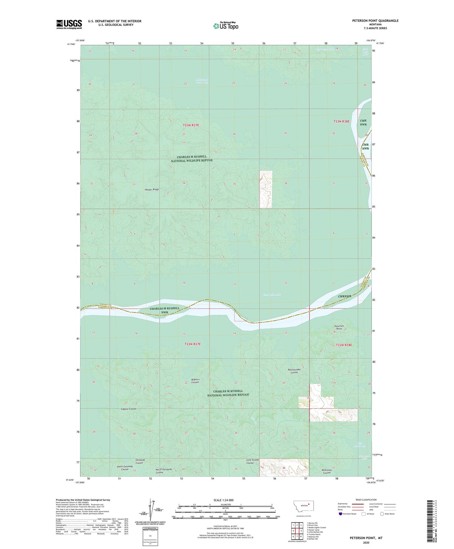
2020 topographic map quadrangle Peterson Point in the state of Montana. Scale: 1:24000. Based on the newly updated USGS 7.5' US Topo map series, this map is in the following counties: Valley, Garfield. The map contains contour data, water features, and other items you are used to seeing on USGS maps, but also has updated roads and other features. This is the next generation of topographic maps. Printed on high-quality waterproof paper with UV fade-resistant inks.
Quads adjacent to this one:
West: Harper Camp
Northwest: Murray Hill
North: Brown Pass
Northeast: Middle Eighth Coulee
East: Little Buffalo Hill
Southeast: Buffalo Hill
South: Maloney Hill
Southwest: Trumbo Ranch
Contains the following named places: 22N37E04CCBC01 Well, 23N37E20DABA01 Well, Bighorn Coulee, Cole Creek, Coyote Coulee, Getaway Coulee, McKinnon Coulee, Ninth Point School, North Getaway Coulee, Peterson Point, Rattlesnake Coulee, Snow Creek Bay, South Getaway Coulee, Sutherland Creek, Sutherland Creek Bay