MyTopo
Threemile Buttes Montana US Topo Map
Couldn't load pickup availability
Also explore the Threemile Buttes Forest Service Topo of this same quad for updated USFS data
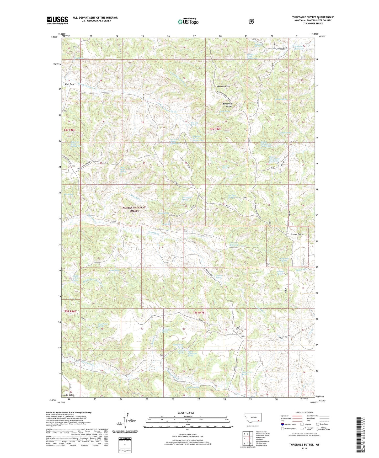
2024 topographic map quadrangle Threemile Buttes in the state of Montana. Scale: 1:24000. Based on the newly updated USGS 7.5' US Topo map series, this map is in the following counties: Powder River. The map contains contour data, water features, and other items you are used to seeing on USGS maps, but also has updated roads and other features. This is the next generation of topographic maps. Printed on high-quality waterproof paper with UV fade-resistant inks.
Quads adjacent to this one:
West: Yager Butte
Northwest: Coleman Draw
North: Home Creek Butte
Northeast: Samuelson Ranch
East: Sonnette
Southeast: Hodsdon Flats
South: Phillips Butte
Southwest: Goodspeed Butte
This map covers the same area as the classic USGS quad with code o45105d8.
Contains the following named places: 04S47E12CABD01 Well, 05S47E10BCAB01 Well, 05S47E19BCBA01 Well, Abbott Spring, Anchor Spring, Blue Bore Spring, Bottles School, Bowers Reservoir, Butte Spring, Collinge Spring, Dalzells Spring, Dead Horse Spring, Doonan Spring, Joe Spring, Joe Yager Spring, Knudson Spring, Knudson Spring Number Two, Mankameyer Spring, McLennon Spring Number One, McLennon Spring Number Two, Middle Creek Spring, Montgomery Spring, Old Faithful Spring, Ole Spring, Otter Division, Phillips Well, Potter Spring, Quebbeman Spring, Ridenour Reservoir, Roundup Creek, Sawmill Spring, Script Spring, Skinner Gulch Spring Number One, Skinner Gulch Spring Number Two, Spring Creek, Spring Creek Spring, Sterling Mine, Tenmile Spring, Tenmile Well, Threemile Buttes, Upper Fifteenmile Spring, Watt Draw, Watt Draw Spring Number One, Watt Spring, Wild Hog Spring