MyTopo
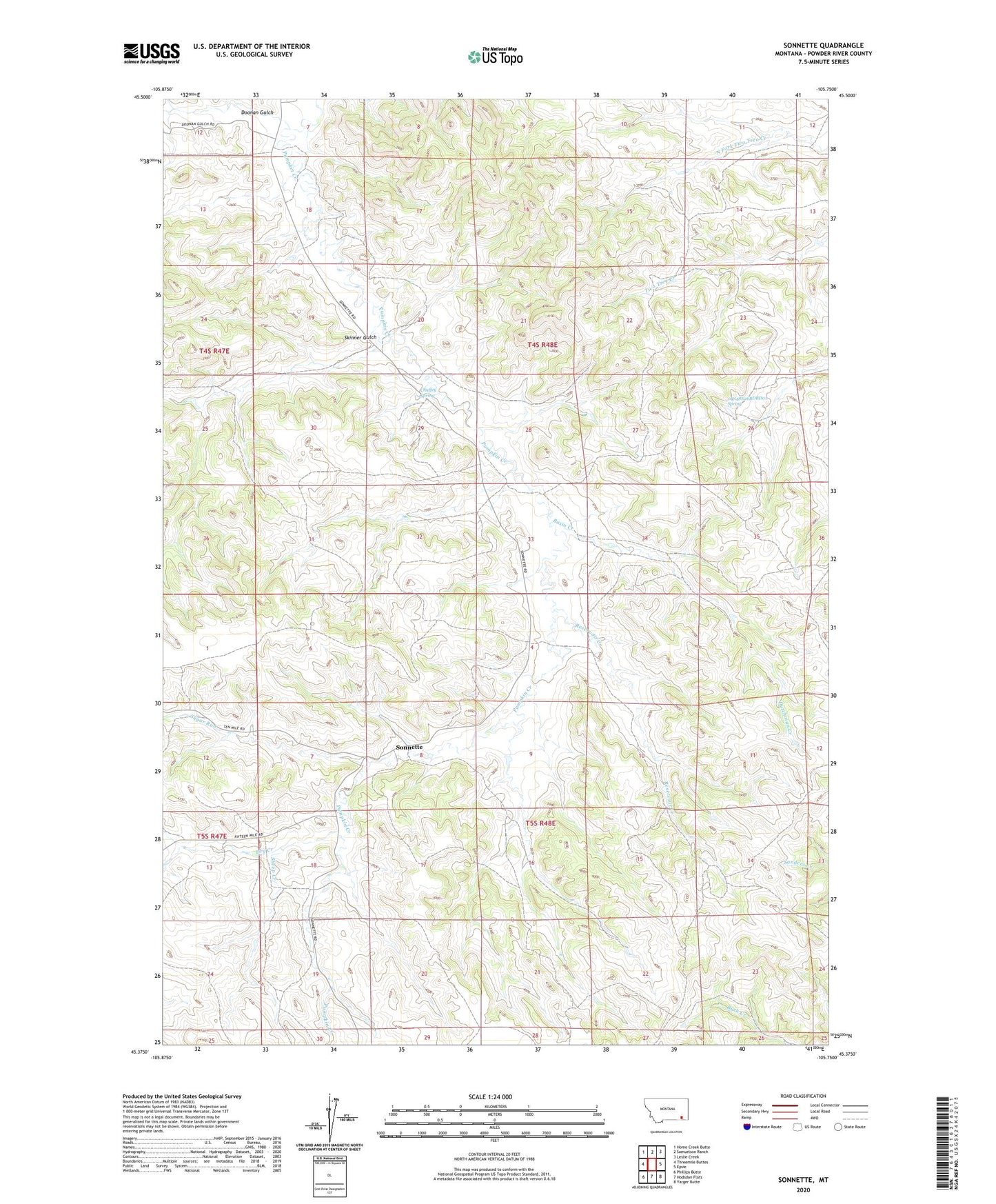
Sonnette Montana US Topo Map
Couldn't load pickup availability
Also explore the Sonnette Forest Service Topo of this same quad for updated USFS data
2024 topographic map quadrangle Sonnette in the state of Montana. Scale: 1:24000. Based on the newly updated USGS 7.5' US Topo map series, this map is in the following counties: Powder River. The map contains contour data, water features, and other items you are used to seeing on USGS maps, but also has updated roads and other features. This is the next generation of topographic maps. Printed on high-quality waterproof paper with UV fade-resistant inks.
Quads adjacent to this one:
West: Threemile Buttes
Northwest: Home Creek Butte
North: Samuelson Ranch
Northeast: Leslie Creek
East: Epsie
Southeast: Yarger Butte
South: Hodsdon Flats
Southwest: Phillips Butte
This map covers the same area as the classic USGS quad with code o45105d7.
Contains the following named places: 04S48E18BACD01 Well, 04S48E20CBDC01 Well, 04S48E20CC__01 Well, 04S48E26ACAC01 Well, 04S48E26BDBD01 Spring, 04S48E28CBCC01 Well, 04S48E34DDBB01 Well, 05S48E04CADC01 Well, 05S48E16BDAB01 Well, Basin Creek, Chuffey Spring, Doonan Gulch, Dry Creek, Dutchman Creek, Mitchell School, Reservoir Creek, Sheep Creek, Skinner Gulch, Sonnette, Sugar Run, Two Tree Mine