
MyTopo
Pilot Rock Montana US Topo Map
Couldn't load pickup availability
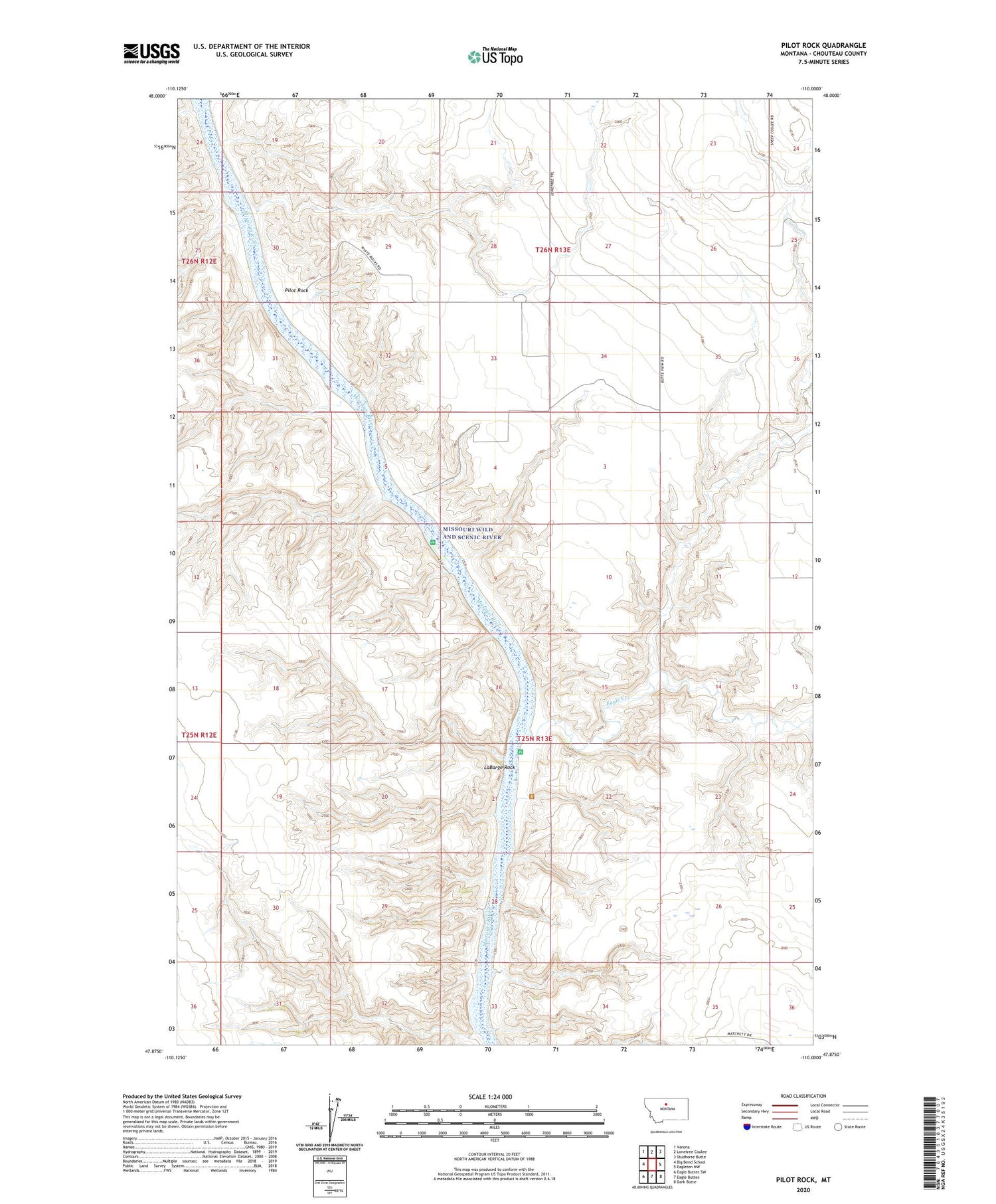
2020 topographic map quadrangle Pilot Rock in the state of Montana. Scale: 1:24000. Based on the newly updated USGS 7.5' US Topo map series, this map is in the following counties: Chouteau. The map contains contour data, water features, and other items you are used to seeing on USGS maps, but also has updated roads and other features. This is the next generation of topographic maps. Printed on high-quality waterproof paper with UV fade-resistant inks.
Quads adjacent to this one:
West: Big Bend School
Northwest: Verona
North: Lonetree Coulee
Northeast: Studhorse Butte
East: Eagleton NW
Southeast: Dark Butte
South: Eagle Buttes
Southwest: Eagle Buttes SW
Contains the following named places: Coal Mine Coulee, Conley Post Office, Crooked Coulee, Cut Bank Coulee, Eagle Butte Post Office, Eagle Creek, Eagle Creek Fishing Access Site, Fortress Rock, LaBarge Rock, Otto Silvan Dam, Pegar Fish Dam, Pilot Rock, Sheep Coulee, White Rocks


