MyTopo
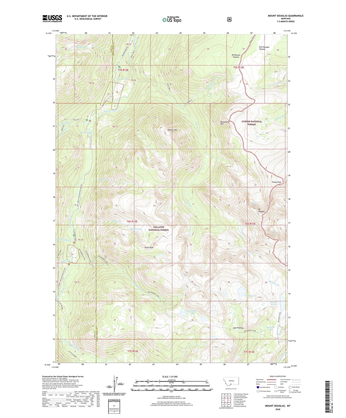
Mount Douglas Montana US Topo Map
Couldn't load pickup availability
Also explore the Mount Douglas Forest Service Topo of this same quad for updated USFS data
2024 topographic map quadrangle Mount Douglas in the state of Montana. Scale: 1:24000. Based on the newly updated USGS 7.5' US Topo map series, this map is in the following counties: Sweet Grass, Park. The map contains contour data, water features, and other items you are used to seeing on USGS maps, but also has updated roads and other features. This is the next generation of topographic maps. Printed on high-quality waterproof paper with UV fade-resistant inks.
Quads adjacent to this one:
West: The Needles
Northwest: West Boulder Plateau
North: Chrome Mountain
Northeast: Picket Pin Mountain
East: Tumble Mountain
Southeast: Pinnacle Mountain
South: Haystack Peak
Southwest: Iron Mountain
This map covers the same area as the classic USGS quad with code o45110c2.
Contains the following named places: Armour Pond, Box Canyon Guard Station, Bramble Creek, Breakneck Mountain, Breakneck Plateau, Bridge Creek, Camp Mimanagish, Christikon, Clear Creek, Cowles Post Office, East Fork Boulder River, Emerald Lake, Fourmile Creek, Fourmile Guard Station, Hawley Creek, Hawley Mountain, Hells Canyon Campground, Hicks Park Campground, Hicks Peak, Hicks Post Office, Horseshoe Lake, Lazy Day, Lazy Day Post Office, Lazy Day Ranch, Meatrack Creek, Mirror Lake, Mount Douglas, North Fork Hawley Creek, Rainbow Lakes, Ruby Creek, Snowslide Creek, Snowy Peak, Trout Lake, Upsidedown Creek