MyTopo
Pipestone Pass Montana US Topo Map
Couldn't load pickup availability
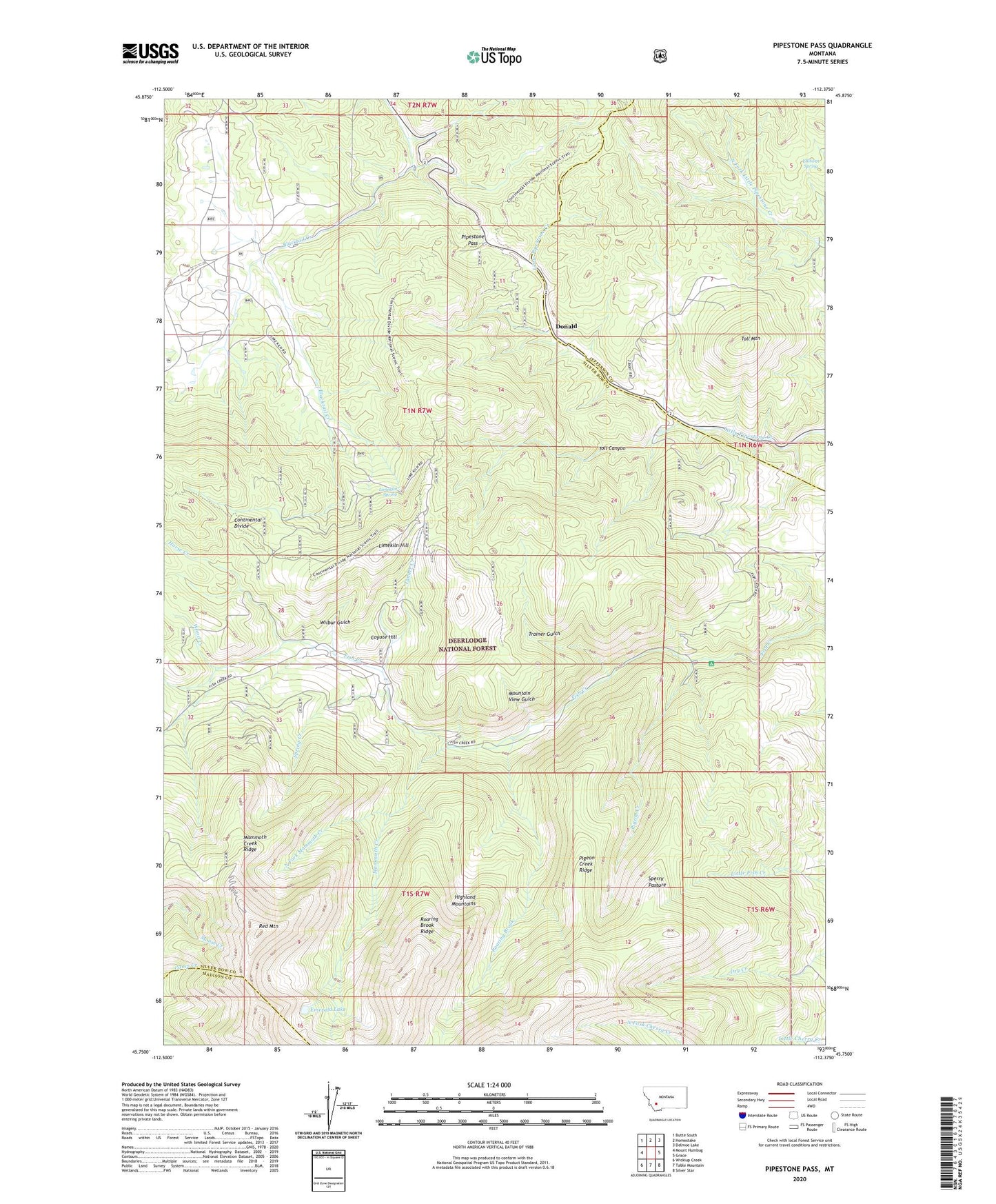
2020 topographic map quadrangle Pipestone Pass in the state of Montana. Scale: 1:24000. Based on the newly updated USGS 7.5' US Topo map series, this map is in the following counties: Silver Bow, Jefferson, Madison. The map contains contour data, water features, and other items you are used to seeing on USGS maps, but also has updated roads and other features. This is the next generation of topographic maps. Printed on high-quality waterproof paper with UV fade-resistant inks.
Quads adjacent to this one:
West: Mount Humbug
Northwest: Butte South
North: Homestake
Northeast: Delmoe Lake
East: Grace
Southeast: Silver Star
South: Table Mountain
Southwest: Wickiup Creek
Contains the following named places: Coyote Hill, Donald, Elkhorn Spring, Emerald Lake, Highland Lookout, Horse Creek, Latrobe, Limekiln Hill, Limekiln Spring, Mammoth Creek, Mammoth Creek Ridge, Mount Horeb Post Office, Mountain View Gulch, North Fork Mammoth Creek, Pigeon Creek, Pigeon Creek Campground, Pigeon Creek Ridge, Pipestone Pass, Red Mountain, Red Mountain Post Office, Roaring Brook, Roaring Brook Ridge, SE NW Section 18 Mine, Sperry Pasture, Spring Creek, Tanner Creek, Toll Canyon, Toll Mountain, Trainer Gulch, Wilbur Gulch, Wood Creek