MyTopo
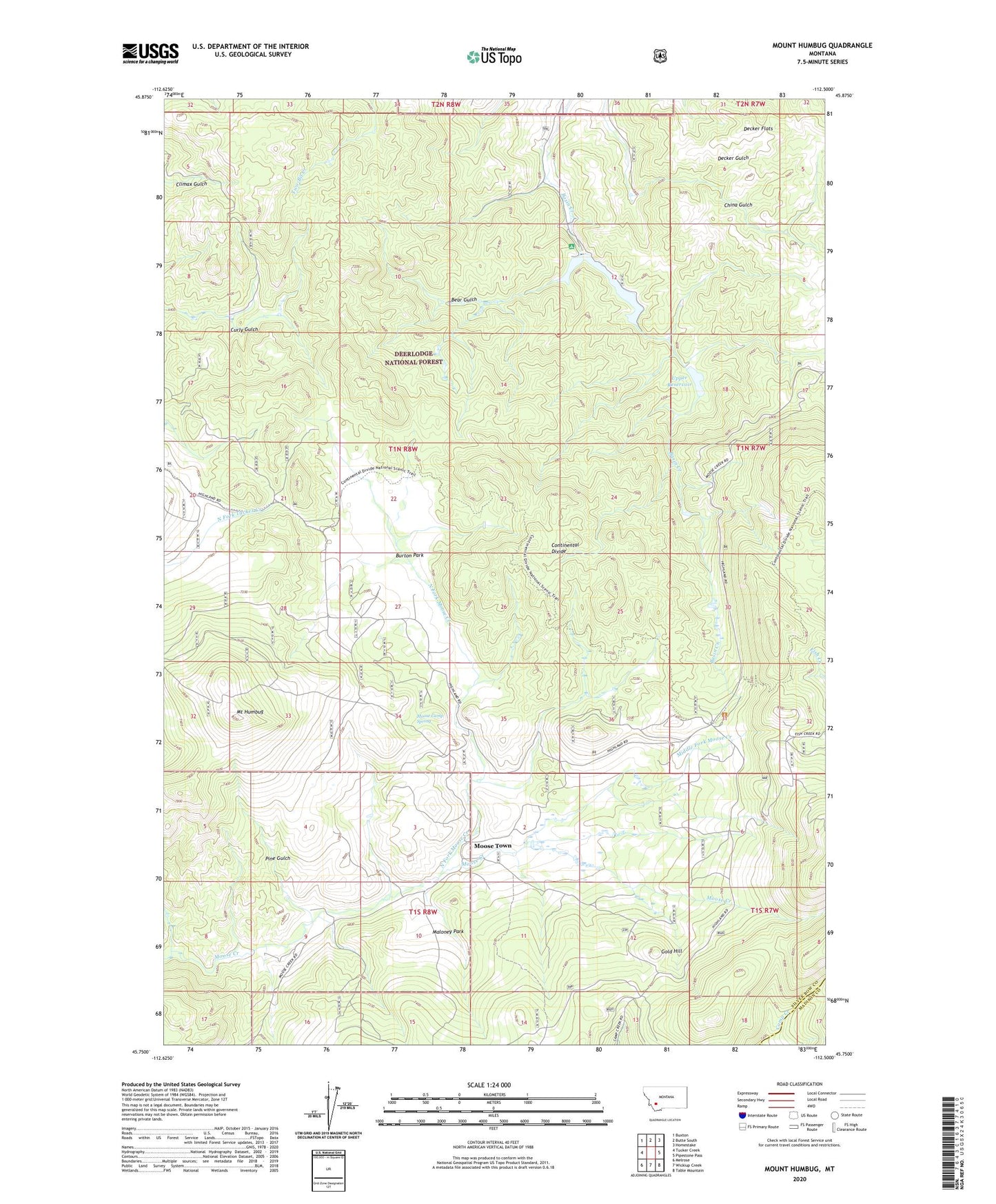
Mount Humbug Montana US Topo Map
Couldn't load pickup availability
Also explore the Mount Humbug Forest Service Topo of this same quad for updated USFS data
2024 topographic map quadrangle Mount Humbug in the state of Montana. Scale: 1:24000. Based on the newly updated USGS 7.5' US Topo map series, this map is in the following counties: Silver Bow, Madison. The map contains contour data, water features, and other items you are used to seeing on USGS maps, but also has updated roads and other features. This is the next generation of topographic maps. Printed on high-quality waterproof paper with UV fade-resistant inks.
Quads adjacent to this one:
West: Tucker Creek
Northwest: Buxton
North: Butte South
Northeast: Homestake
East: Pipestone Pass
Southeast: Table Mountain
South: Wickiup Creek
Southwest: Melrose
This map covers the same area as the classic USGS quad with code o45112g5.
Contains the following named places: Basin Creek Dam Number 1, Basin Creek Dam Number 2, Basin Creek Park, Basin Creek Reservoir, Bear Gulch, Burton Park, Decker Flats, Decker Gulch, Gold Hill, Highland City, Highland Mine, Maloney Park, Middle Fork Moose Creek, Moose Camp Spring, Moose Creek Post Office, Moose Town, Mount Humbug, North Fork Moose Creek, NW SE Section 21 Mine, Pine Gulch, Royston, SE NE Section 9 Mine, Upper Reservoir, W SE Section 9 Mine