MyTopo
Table Mountain Montana US Topo Map
Couldn't load pickup availability
Also explore the Table Mountain Forest Service Topo of this same quad for updated USFS data
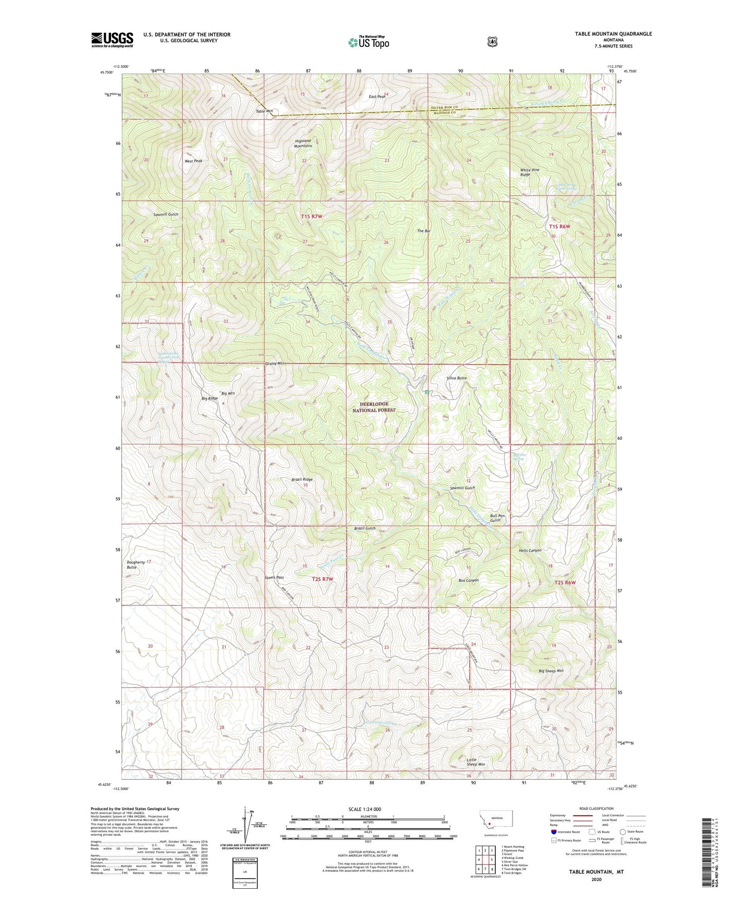
2024 topographic map quadrangle Table Mountain in the state of Montana. Scale: 1:24000. Based on the newly updated USGS 7.5' US Topo map series, this map is in the following counties: Madison, Silver Bow. The map contains contour data, water features, and other items you are used to seeing on USGS maps, but also has updated roads and other features. This is the next generation of topographic maps. Printed on high-quality waterproof paper with UV fade-resistant inks.
Quads adjacent to this one:
West: Wickiup Creek
Northwest: Mount Humbug
North: Pipestone Pass
Northeast: Grace
East: Silver Star
Southeast: Twin Bridges
South: Twin Bridges SW
Southwest: Nez Perce Hollow
This map covers the same area as the classic USGS quad with code o45112f4.
Contains the following named places: Big Bonanza Mine, Big Mountain, Big Ridge, Big Sheep Mountain, Billy Johns Trail, Box Canyon, Brazil Gulch, Brazil Pack Trail, Brazil Ridge, Bull Pen Gulch, Bull Pen Spring, Dougherty Butte, East Fork Hell Creek, East Peak, Elgin Mine, Grassy Mountain, Hells Canyon Guard Station, Highland Mountains, Julia Lee Mine, Little Cherry Creek Springs, Little Sheep Mountain, NE Section 32 Mine, Sawmill Gulch, Second Creek, Seidensticker Number Two Spring, Silica Butte, Steels Pass, Steels Pass Creek, SW Section 29 Mine, Table Mountain, The Bar, Third Creek, West Peak, White Pine Ridge, ZIP Code: 59751