MyTopo
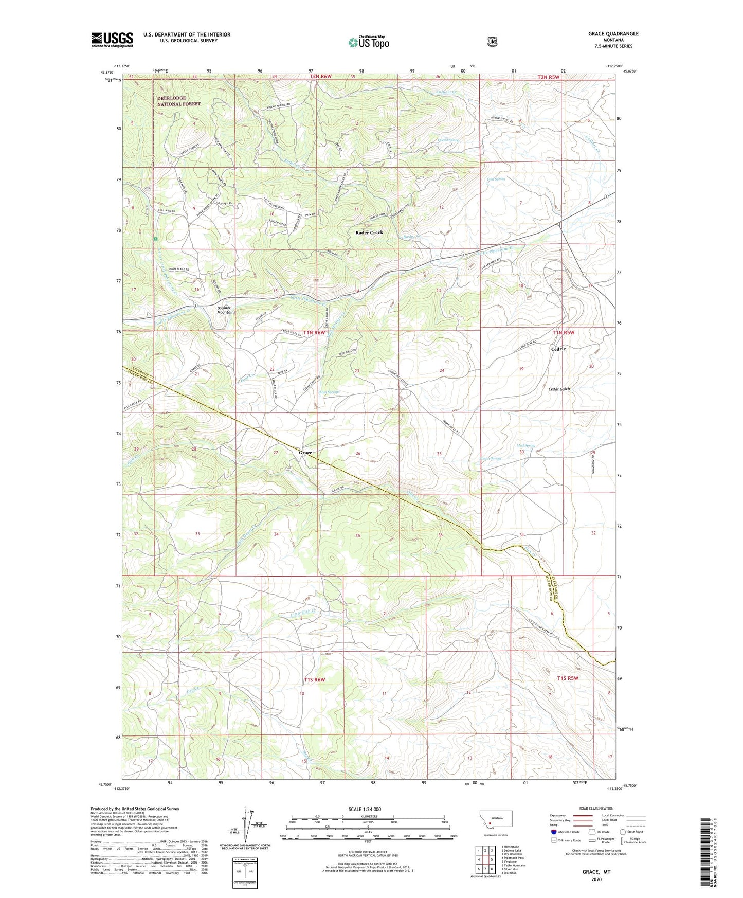
Grace Montana US Topo Map
Couldn't load pickup availability
Also explore the Grace Forest Service Topo of this same quad for updated USFS data
2024 topographic map quadrangle Grace in the state of Montana. Scale: 1:24000. Based on the newly updated USGS 7.5' US Topo map series, this map is in the following counties: Jefferson, Silver Bow. The map contains contour data, water features, and other items you are used to seeing on USGS maps, but also has updated roads and other features. This is the next generation of topographic maps. Printed on high-quality waterproof paper with UV fade-resistant inks.
Quads adjacent to this one:
West: Pipestone Pass
Northwest: Homestake
North: Delmoe Lake
Northeast: Dry Mountain
East: Vendome
Southeast: Waterloo
South: Silver Star
Southwest: Table Mountain
This map covers the same area as the classic USGS quad with code o45112g3.
Contains the following named places: Cactus Junction, Cedric, Colbert Creek, Cold Spring, Friend Spring, Grace, Grace Post Office, Little Fish Creek, Montana State Highway Department Section House, Mud Spring, Mud Springs, Mud Springs Creek, NE SW Section 14 Mine, Nineteen Mile, North Fork Little Pipestone Creek, Poison Spring, Rader Creek, Rader Creek Census Designated Place, Root Creek, SE SW Section 7 Mine, Toll Mountain Campground, Two Heart Creek