MyTopo
Pleasant Prairie Montana US Topo Map
Couldn't load pickup availability
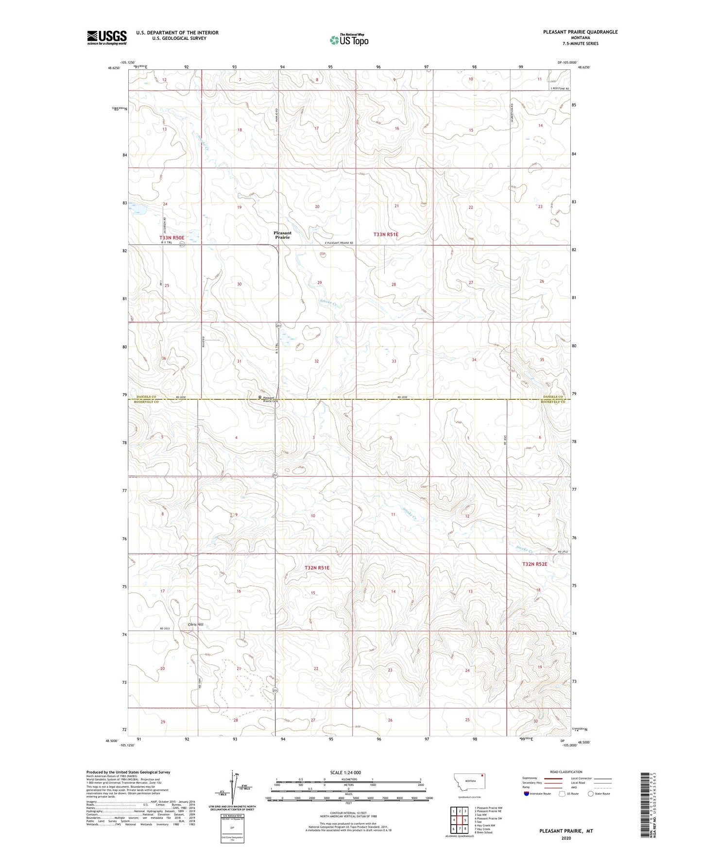
2024 topographic map quadrangle Pleasant Prairie in the state of Montana. Scale: 1:24000. Based on the newly updated USGS 7.5' US Topo map series, this map is in the following counties: Roosevelt, Daniels. The map contains contour data, water features, and other items you are used to seeing on USGS maps, but also has updated roads and other features. This is the next generation of topographic maps. Printed on high-quality waterproof paper with UV fade-resistant inks.
Quads adjacent to this one:
West: Pleasant Prairie SW
Northwest: Pleasant Prairie NW
North: Pleasant Prairie NE
Northeast: Soo NW
East: Soo
Southeast: Biem School
South: Hay Creek
Southwest: Hay Creek NW
This map covers the same area as the classic USGS quad with code o48105e1.
Contains the following named places: 32N51E05BAAA01 Well, 32N51E05BAAB01 Well, 32N51E05BAAB02 Well, 32N51E17DCCC01 Well, 32N51E20ABBA01 Well, 33N50E24BDDC01 Well, 33N50E24DCBB01 Well, 33N50E25ABBC01 Well, 33N51E20DCCC01 Well, 33N51E28BAAC01 Well, 33N51E29BBBA01 Well, 33N51E35CBCA01 Well, Chris Hill, J Jacobsen Number 1 Dam, J Jacobsen Number 2 Dam, Pleasant Prairie, Pleasant Prairie Cemetery, Pleasant Prairie Community Hall, Pleasant Prairie Lutheran Church, Westby School Center