MyTopo
Soo NW Montana US Topo Map
Couldn't load pickup availability
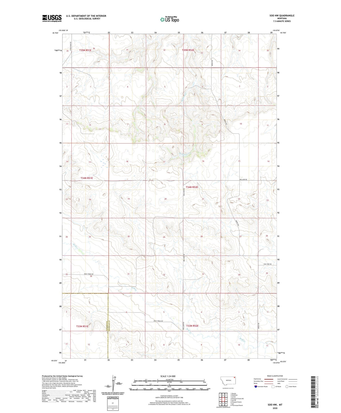
2024 topographic map quadrangle Soo NW in the state of Montana. Scale: 1:24000. Based on the newly updated USGS 7.5' US Topo map series, this map is in the following counties: Sheridan, Daniels. The map contains contour data, water features, and other items you are used to seeing on USGS maps, but also has updated roads and other features. This is the next generation of topographic maps. Printed on high-quality waterproof paper with UV fade-resistant inks.
Quads adjacent to this one:
West: Pleasant Prairie NE
Northwest: Navajo
North: Redstone
Northeast: Archer
East: Soo NE
Southeast: Thornwood Ranch
South: Soo
Southwest: Pleasant Prairie
This map covers the same area as the classic USGS quad with code o48104f8.
Contains the following named places: 34N52E03BA__01 Well, 34N52E33CA__01 Well, Ashdale Post Office, Garneau School, Phellps School, Wanso, Wanso Post Office, Whitney School