MyTopo
Poplar NE Montana US Topo Map
Couldn't load pickup availability
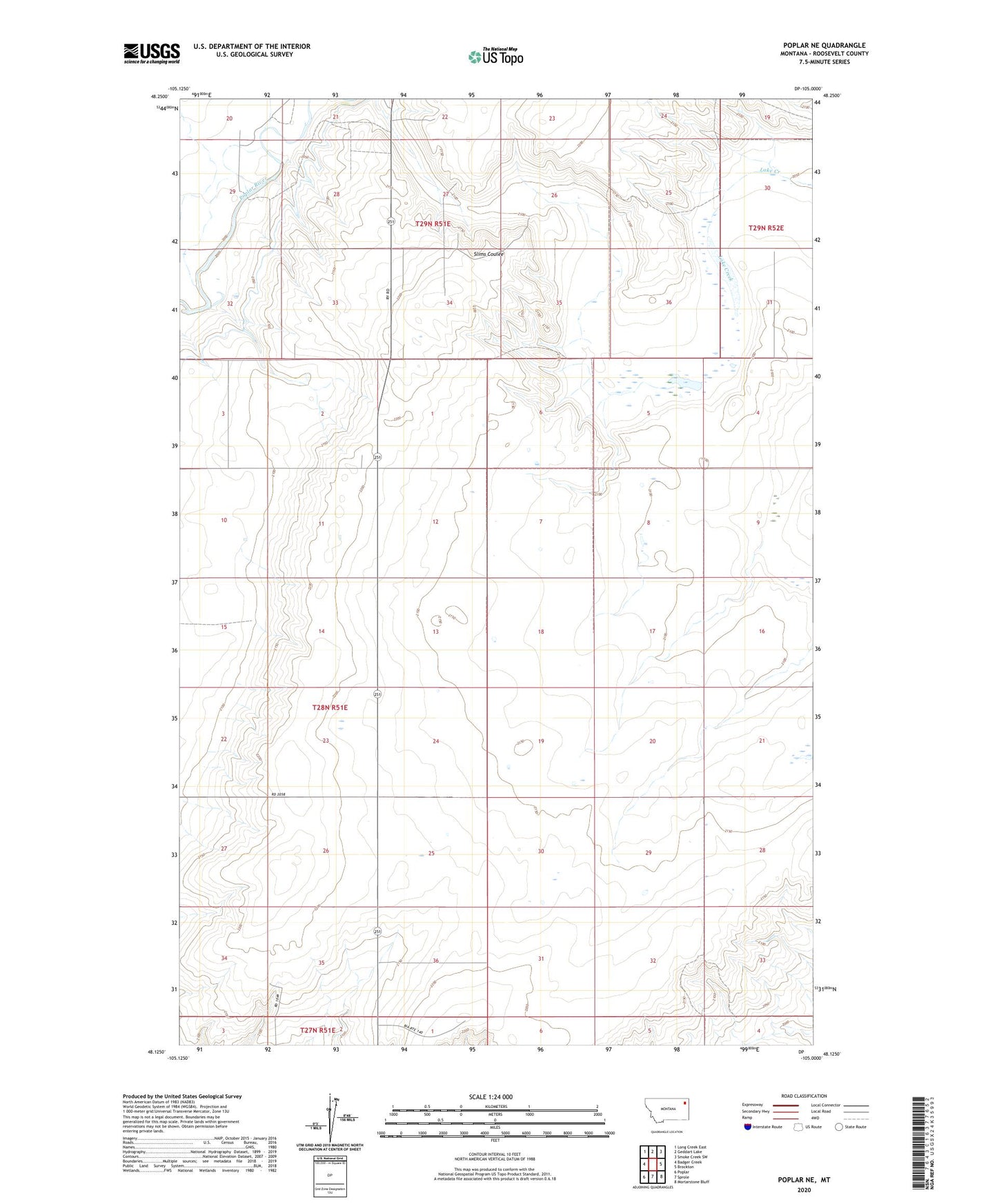
2024 topographic map quadrangle Poplar NE in the state of Montana. Scale: 1:24000. Based on the newly updated USGS 7.5' US Topo map series, this map is in the following counties: Roosevelt. The map contains contour data, water features, and other items you are used to seeing on USGS maps, but also has updated roads and other features. This is the next generation of topographic maps. Printed on high-quality waterproof paper with UV fade-resistant inks.
Quads adjacent to this one:
West: Badger Creek
Northwest: Long Creek East
North: Geddart Lake
Northeast: Smoke Creek SW
East: Brockton
Southeast: Mortarstone Bluff
South: Sprole
Southwest: Poplar
This map covers the same area as the classic USGS quad with code o48105b1.
Contains the following named places: 27N51E01BA__01 Well, 28N51E01BBBB01 Well, 28N51E02AC__01 Well, 28N51E12CC__01 Well, 28N51E13CCCA01 Well, 28N51E13CCCA02 Well, 28N51E13CCCC01 Well, 28N51E22CDCC01 Well, 28N51E22CDCC02 Well, 28N51E25AC__01 Well, 28N51E27ABAA01 Well, 28N51E27AC__01 Well, 28N52E18AC__01 Well, 28N52E19AA__01 Well, 28N52E19AA__02 Well, 28N52E20BBBB01 Well, 28N52E20CCCC01 Well, 28N52E29CD__01 Well, 28N52E29CD__02 Well, 28N52E30DDDD01 Well, 29N51E21DDAC01 Well, 29N51E29CBBB01 Well, 29N51E31AABB01 Well, 29N51E32ABAC01 Well, 29N51E32ACCA01 Well, 29N51E32BAAD01 Well, 29N51E32BABB01 Well, 29N51E32BABB02 Well, 29N51E32BBAA01 Well, 29N51E32BBBA01 Well, 29N51E32BBBA02 Well, 29N51E32BBBA03 Well, 29N51E32BBBA04 Well, 29N51E32BBBB01 Well, 29N51E32BCCA01 Well, 29N51E32BCCA02 Well, 29N51E36CBBB01 Well, 29N51E36CCCC01 Well, East Poplar Oil Field