MyTopo
Smoke Creek SW Montana US Topo Map
Couldn't load pickup availability
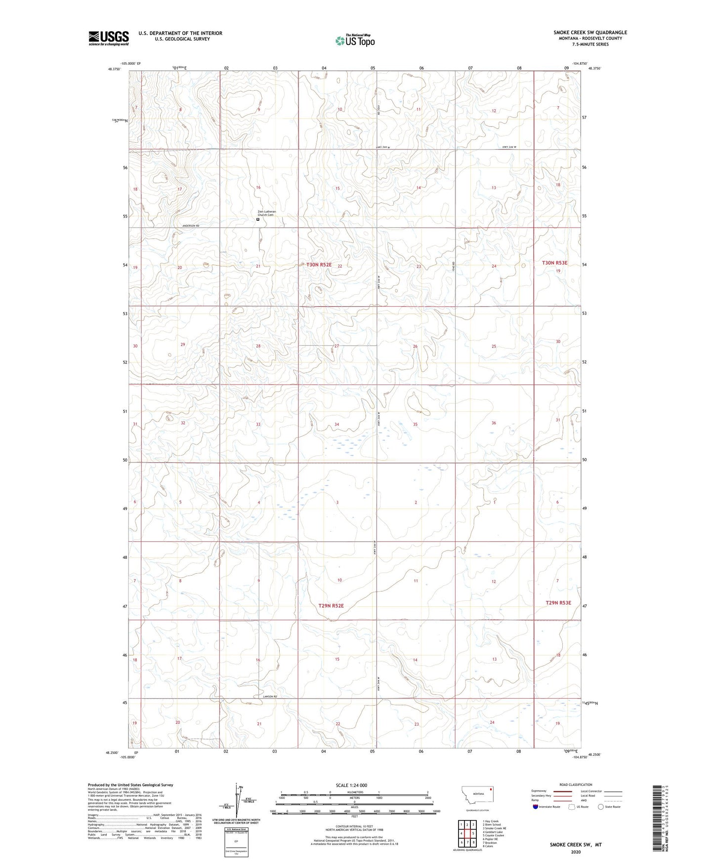
2024 topographic map quadrangle Smoke Creek SW in the state of Montana. Scale: 1:24000. Based on the newly updated USGS 7.5' US Topo map series, this map is in the following counties: Roosevelt. The map contains contour data, water features, and other items you are used to seeing on USGS maps, but also has updated roads and other features. This is the next generation of topographic maps. Printed on high-quality waterproof paper with UV fade-resistant inks.
Quads adjacent to this one:
West: Geddart Lake
Northwest: Hay Creek
North: Biem School
Northeast: Smoke Creek NE
East: Coyote Coulee
Southeast: Calais
South: Brockton
Southwest: Poplar NE
This map covers the same area as the classic USGS quad with code o48104c8.
Contains the following named places: 30N52E13ABAB01 Well, 30N52E24CCCC01 Well, 30N52E35AAAA01 Well, Anderson, Anderson School, Faith Free Lutheran Church, Nelson School, Zion Lutheran Church, Zion Lutheran Church Cemetery