MyTopo
Geddart Lake Montana US Topo Map
Couldn't load pickup availability
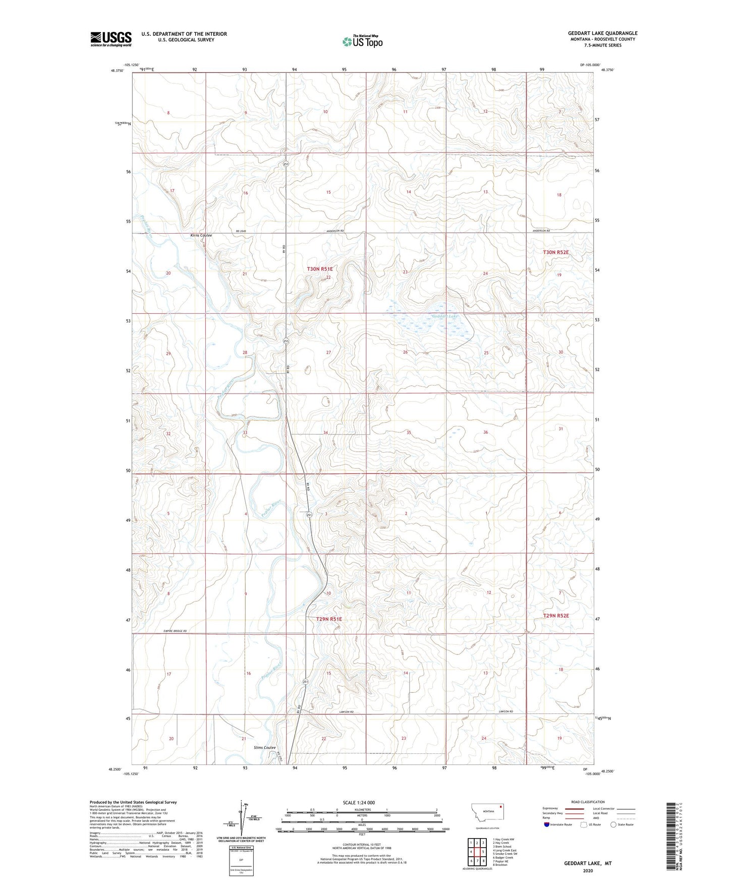
2024 topographic map quadrangle Geddart Lake in the state of Montana. Scale: 1:24000. Based on the newly updated USGS 7.5' US Topo map series, this map is in the following counties: Roosevelt. The map contains contour data, water features, and other items you are used to seeing on USGS maps, but also has updated roads and other features. This is the next generation of topographic maps. Printed on high-quality waterproof paper with UV fade-resistant inks.
Quads adjacent to this one:
West: Long Creek East
Northwest: Hay Creek NW
North: Hay Creek
Northeast: Biem School
East: Smoke Creek SW
Southeast: Brockton
South: Poplar NE
Southwest: Badger Creek
This map covers the same area as the classic USGS quad with code o48105c1.
Contains the following named places: 29N51E03BCDB01 Well, 29N51E03CAAD01 Well, 29N51E03CABA01 Well, 29N51E08CC__01 Well, 29N51E09ABBA01 Well, 29N51E09ABBA02 Well, 29N51E09ABBA03 Well, 29N51E09ABBA04 Well, 29N51E09CA__01 Well, 29N51E10CADD01 Well, 29N51E10CDAA01 Well, 29N51E10CDAB01 Well, 29N51E10CDBA01 Well, 29N51E14ACCC01 Well, 29N51E14BDDA01 Well, 29N51E15CACA01 Well, 29N51E15CCBD01 Well, 29N51E16BDAA01 Well, 29N51E16CBCC01 Well, 29N51E16CCAA01 Well, 29N51E16DACA01 Well, 29N51E16DDDD01 Well, 29N51E20ABBA01 Well, 29N51E20ABBA02 Well, 29N51E20DABB01 Well, 29N51E21ABCB01 Well, 29N51E21ABCC01 Well, 29N51E21ABDA01 Well, 29N51E21BBAA01 Well, 30N51E10CCAD01 Well, 30N51E13DCBC01 Well, 30N51E28DCAA01 Well, Brockton District, Geddart Lake, Graninger Dam, Kerns School, Kirns Coulee, Kirns Ranch, Roosevelt County, Slims Coulee