MyTopo
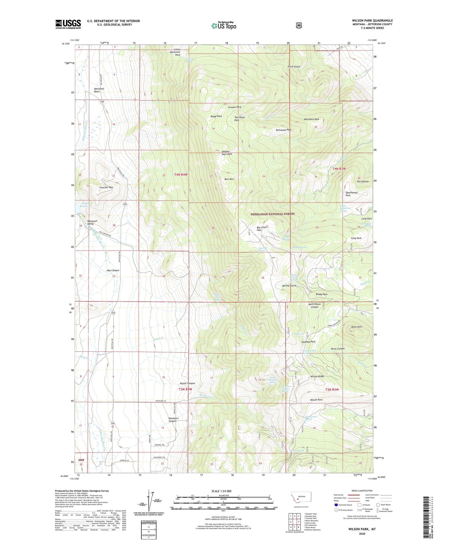
Wilson Park Montana US Topo Map
Couldn't load pickup availability
Also explore the Wilson Park Forest Service Topo of this same quad for updated USFS data
2024 topographic map quadrangle Wilson Park in the state of Montana. Scale: 1:24000. Based on the newly updated USGS 7.5' US Topo map series, this map is in the following counties: Jefferson. The map contains contour data, water features, and other items you are used to seeing on USGS maps, but also has updated roads and other features. This is the next generation of topographic maps. Printed on high-quality waterproof paper with UV fade-resistant inks.
Quads adjacent to this one:
West: Ratio Mountain
Northwest: Boulder West
North: Boulder East
Northeast: Tacoma Park
East: Dunn Creek
Southeast: Doherty Mountain
South: Black Butte
Southwest: Dry Mountain
This map covers the same area as the classic USGS quad with code o46112a1.
Contains the following named places: 03N04W21ABDB01 Well, Basin, Big Chief Park, Big Chief Spring, Brady Park, Bull Mountain, Bull Mountain Game Range, Dearborn Canyon, Dearborn Canyon Spring, Dearborn Creek, Deerhorn Park, Dunn Peak, Elk Run Spring, Fetters Trail, Fletcher Mountain, Grouse Park, Hay Canyon, Keogh Dam, Keogh Ranch, Keogh Reservoir, Little Whitetail Park, Long Park, Lookout Spring, Maggot Spring, McCauley Park, Moulton Creek Dam Number 1, Moulton Reservoir, Mulvey Gulch Spring, Murray Cabin, Nettie Mine, North Dearborn Spring, Pony Creek, Potter Canyon, Potter Creek, Potter Flat Spring, Quaintance Park, Ridge Park, Salsbury, Seldom Seen Park, Simonsen Ranch, Swampy Park, Swampy Park Spring, Sweet Cabin, Tom Spring, Tomahawk Ranch, Trail Spring, Two Pines Park, Upper Quaintance Spring, Valley, Whitetail Basin, Whitetail Valley, Wilson Park, Wilson Park Spring, Wilson Ridge