MyTopo
Ravenna Montana US Topo Map
Couldn't load pickup availability
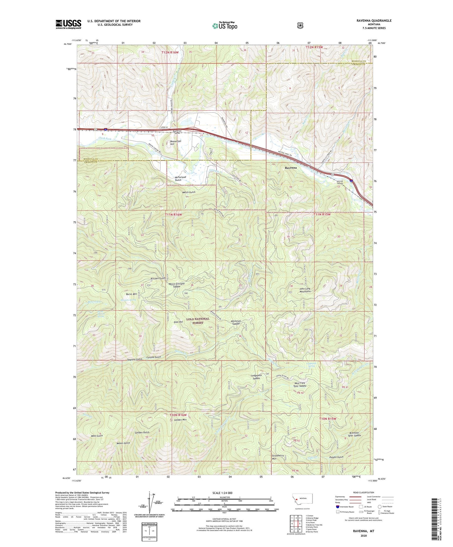
2020 topographic map quadrangle Ravenna in the state of Montana. Scale: 1:24000. Based on the newly updated USGS 7.5' US Topo map series, this map is in the following counties: Granite, Missoula. The map contains contour data, water features, and other items you are used to seeing on USGS maps, but also has updated roads and other features. This is the next generation of topographic maps. Printed on high-quality waterproof paper with UV fade-resistant inks.
Quads adjacent to this one:
West: Iris Point
Northwest: Clinton
North: Mineral Ridge
Northeast: Union Peak
East: Medicine Tree Hill
Southeast: Harvey Point
South: Spink Point
Southwest: Grizzly Point
Contains the following named places: 11N15W07DBCA01 Well, 11N15W07DCDA01 Well, 11N16W09DABB01 Well, 11N16W10CBBB01 Well, 11N16W11AADC01 Well, 11N16W11AADC02 Well, 11N16W11ACAC01 Well, 11N16W11CAAA01 Well, 11N16W11CACC01 Well, 11N16W11CDBA01 Well, 11N16W15AAAB01 Well, 11N16W15AACD01 Well, 11N16W15AADB01 Well, Ancon, Baird, Baird Post Office, Beavertail Hill, Beavertail Hill Campground, Beavertail Hill Recreation Site, Beavertail Hill State Park, Beavertail Pond Fishing Access Site, Beavertail Tunnel, Bonita, Bonita Post Office, Bonita School, Brewster Tyler Saddle, Burnt Mountain, Carlan, Corona Gulch, Cramer Creek, East Hill, Gillispie Creek, Golden Mountain, Horse Pasture Spring, John Long Trail, Lodgepole Saddle, Lodgepole Spring, Marcella Creek, McFarland Gulch, Mormon Spring, Nimrod Tunnels, Potato Gulch, Ravenna, Ryan Creek, Sequoia Gulch, Strawberry Mountain, Welch Gulch, Welch-Gillispie Saddle, West Fork Cramer Creek, West Fork Tyler Saddle, Whitetail Saddle, Willis