MyTopo
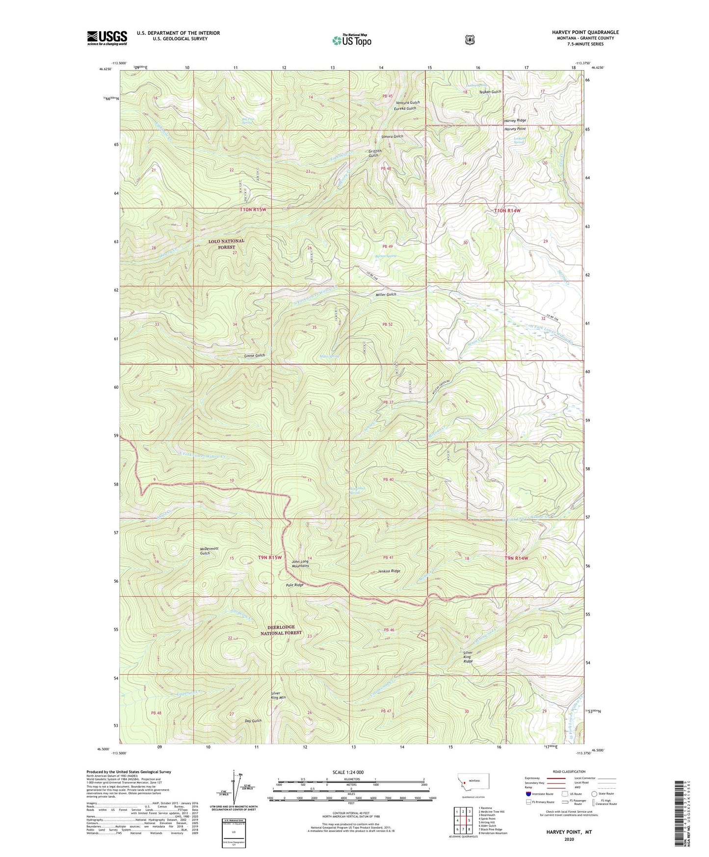
Harvey Point Montana US Topo Map
Couldn't load pickup availability
Also explore the Harvey Point Forest Service Topo of this same quad for updated USFS data
2024 topographic map quadrangle Harvey Point in the state of Montana. Scale: 1:24000. Based on the newly updated USGS 7.5' US Topo map series, this map is in the following counties: Granite. The map contains contour data, water features, and other items you are used to seeing on USGS maps, but also has updated roads and other features. This is the next generation of topographic maps. Printed on high-quality waterproof paper with UV fade-resistant inks.
Quads adjacent to this one:
West: Spink Point
Northwest: Ravenna
North: Medicine Tree Hill
Northeast: Bearmouth
East: Nirling Hill
Southeast: Henderson Mountain
South: Black Pine Ridge
Southwest: Alder Gulch
This map covers the same area as the classic USGS quad with code o46113e4.
Contains the following named places: Barton Spring, Big Pine Spring, Black Pine Trail, Dooley Spring, Drummond Division, Eightmile Creek, Eightmile Harvey Ridge Trail, Eureka Gulch, Goose Gulch, Griffith Cabin, Griffith Gulch, Harvey Cabin, Harvey Point, Harvey Ridge, Horsethief Spring, Jenkins Ridge, Lookout Spring, Miller Gulch, Miller Spring, Mohave Creek, Pole Ridge, Pole Ridge Trail, Senia Creek, Silver King Mountain, Silver King Ridge, Sonora Gulch, Ventura Gulch