MyTopo
Beartrap Mountain Montana US Topo Map
Couldn't load pickup availability
Also explore the Beartrap Mountain Forest Service Topo of this same quad for updated USFS data
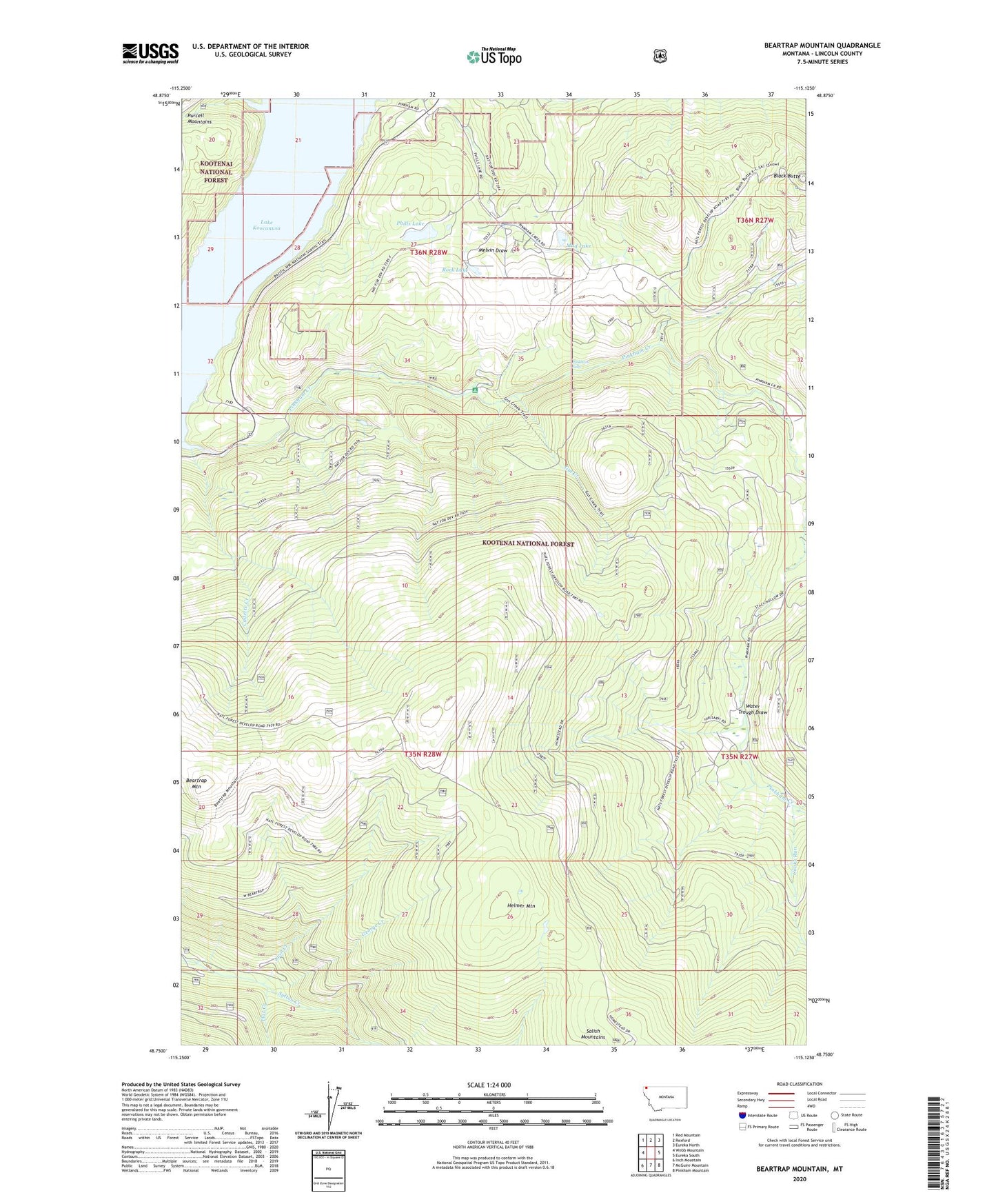
2024 topographic map quadrangle Beartrap Mountain in the state of Montana. Scale: 1:24000. Based on the newly updated USGS 7.5' US Topo map series, this map is in the following counties: Lincoln. The map contains contour data, water features, and other items you are used to seeing on USGS maps, but also has updated roads and other features. This is the next generation of topographic maps. Printed on high-quality waterproof paper with UV fade-resistant inks.
Quads adjacent to this one:
West: Webb Mountain
Northwest: Red Mountain
North: Rexford
Northeast: Eureka North
East: Eureka South
Southeast: Pinkham Mountain
South: McGuire Mountain
Southwest: Inch Mountain
This map covers the same area as the classic USGS quad with code o48115g2.
Contains the following named places: 35N27W06DAAD01 Well, 59930, Beartrap Mountain, Black Butte, Cadette Creek, Cooks Run, Flat Creek, George Creek, Gut Creek, Helmer Mountain, Lion Creek, Mud Lake, Phills Lake, Pinkham Falls, Rock Lake, Rondo, Water Trough Draw