MyTopo
Thompson Coulee Montana US Topo Map
Couldn't load pickup availability
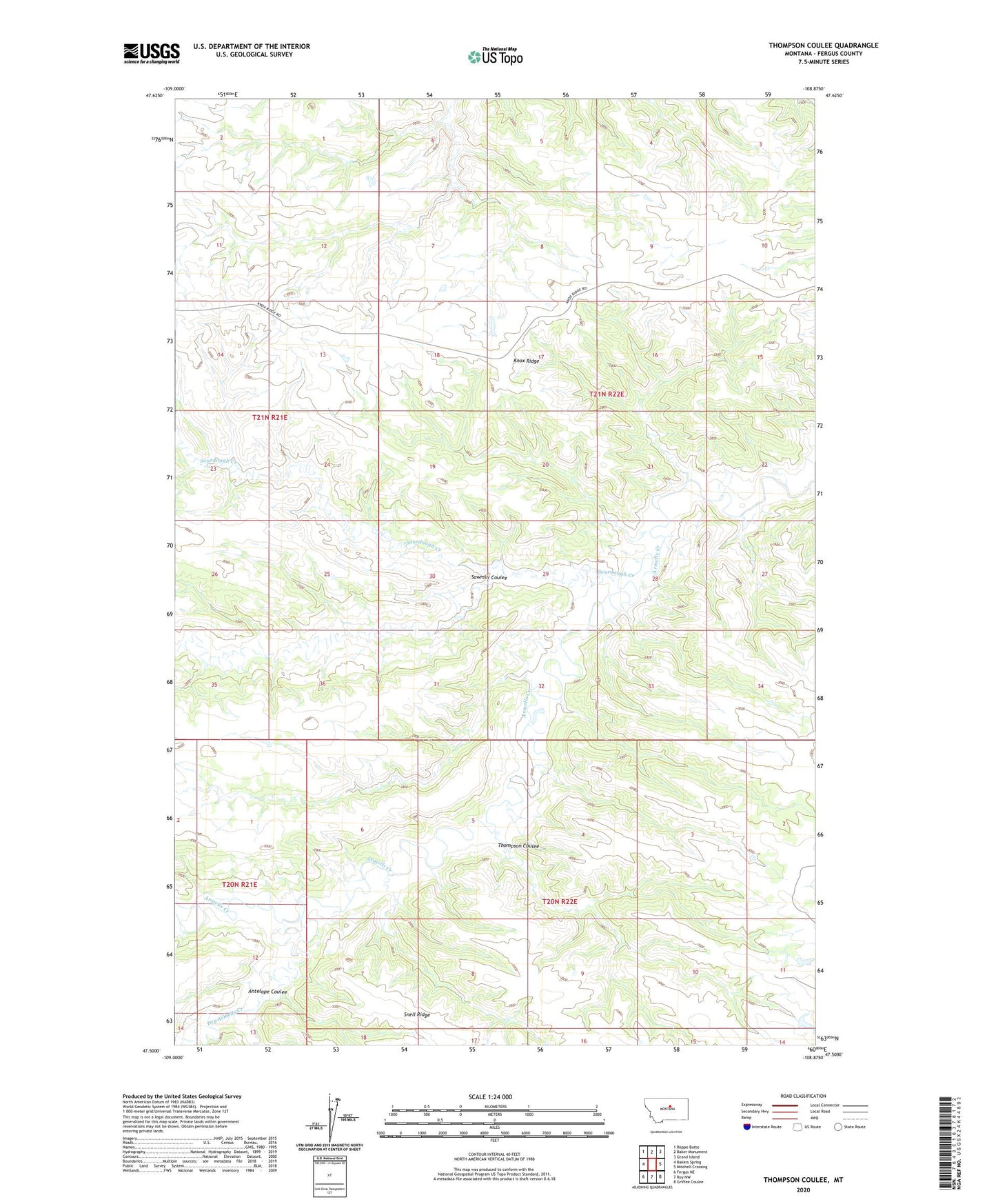
2024 topographic map quadrangle Thompson Coulee in the state of Montana. Scale: 1:24000. Based on the newly updated USGS 7.5' US Topo map series, this map is in the following counties: Fergus. The map contains contour data, water features, and other items you are used to seeing on USGS maps, but also has updated roads and other features. This is the next generation of topographic maps. Printed on high-quality waterproof paper with UV fade-resistant inks.
Quads adjacent to this one:
West: Bakers Spring
Northwest: Reppe Butte
North: Baker Monument
Northeast: Grand Island
East: Mitchell Crossing
Southeast: Griffee Coulee
South: Roy NW
Southwest: Fergus NE
This map covers the same area as the classic USGS quad with code o47108e8.
Contains the following named places: 20N21E12BD__01 Well, 20N22E11ABB_01 Well, Antelope Coulee, Dry Armells Creek, Mauland Post Office, Murray Dam, Sawmill Coulee, Sourdough Creek, Thompson Coulee