MyTopo
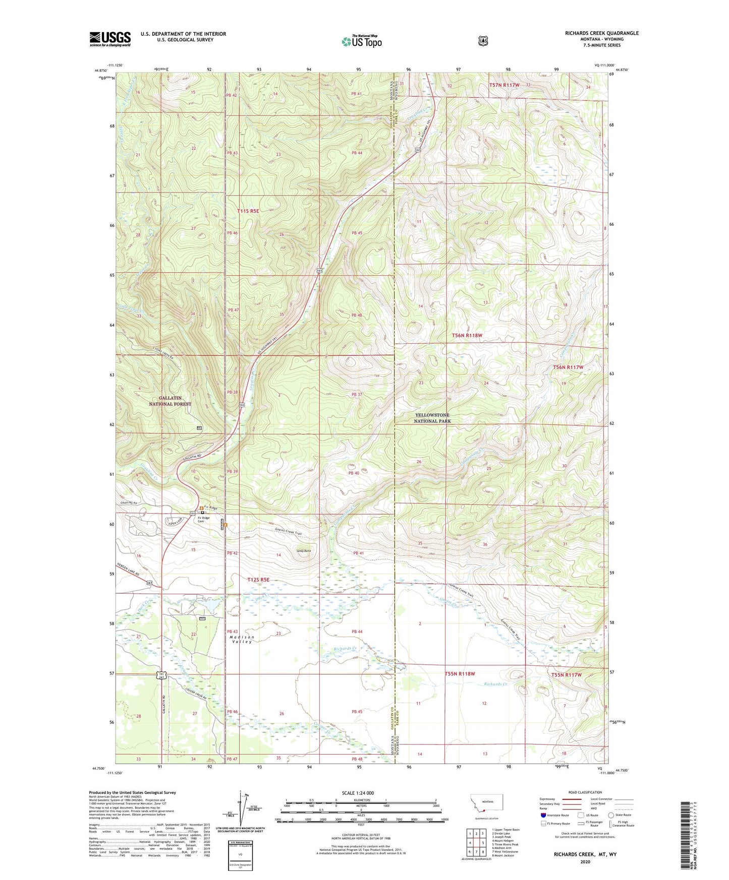
Richards Creek Montana US Topo Map
Couldn't load pickup availability
Also explore the Richards Creek Forest Service Topo of this same quad for updated USFS data
2024 topographic map quadrangle Richards Creek in the state of Montana. Scale: 1:24000. Based on the newly updated USGS 7.5' US Topo map series, this map is in the following counties: Gallatin, Park. The map contains contour data, water features, and other items you are used to seeing on USGS maps, but also has updated roads and other features. This is the next generation of topographic maps. Printed on high-quality waterproof paper with UV fade-resistant inks.
Quads adjacent to this one:
West: Mount Hebgen
Northwest: Upper Tepee Basin
North: Divide Lake
Northeast: Joseph Peak
East: Three Rivers Peak
Southeast: Mount Jackson
South: West Yellowstone
Southwest: Madison Arm
Contains the following named places: 12S05E22ABCB01 Well, Campanula Creek, East Fork Tepee Creek, Fir Ridge Cemetery, Gneiss Creek, Little Tepee Creek, Real Close Dam, Richards Creek, Sandy Butte, Tepee Creek, Yellowstone National Park Division